| Vajragad
|
| At a Glance |
| Trek |
Vajragad |
| Alias |
Rudramal |
| Type |
Hill Fort |
| District |
Pune |
| Height above mean sea
level |
4444 ft (~1355 m) |
| Base
Village |
Narayanpur |
| Minimum
Duration |
2 days |
| Region |
Pune |
| Transport |
Kalyan
to Pune (road/rail, ~ 150 km)- Narayanpur
(road, ~ 40 km) (Vehicle like jeep can reach upto the
level of Purandeshwar mandir now). |
| Time to
reach the top |
About 3 1/2 hrs from base village
(About 45 minutes from Purandeshwar mandir of
Purandar. From manidr, Vajragad top is about
1 hr trek) |
| Water
Availability |
Potable water isn't available on the top |
| Best
season to visit |
November to
February |
| Sights to
visit |
Mahadarwaja, Hanuman mandir, water cisterns |
| Difficulty Rating |
Simple |
| Shelter |
- | |
| Location |
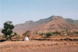
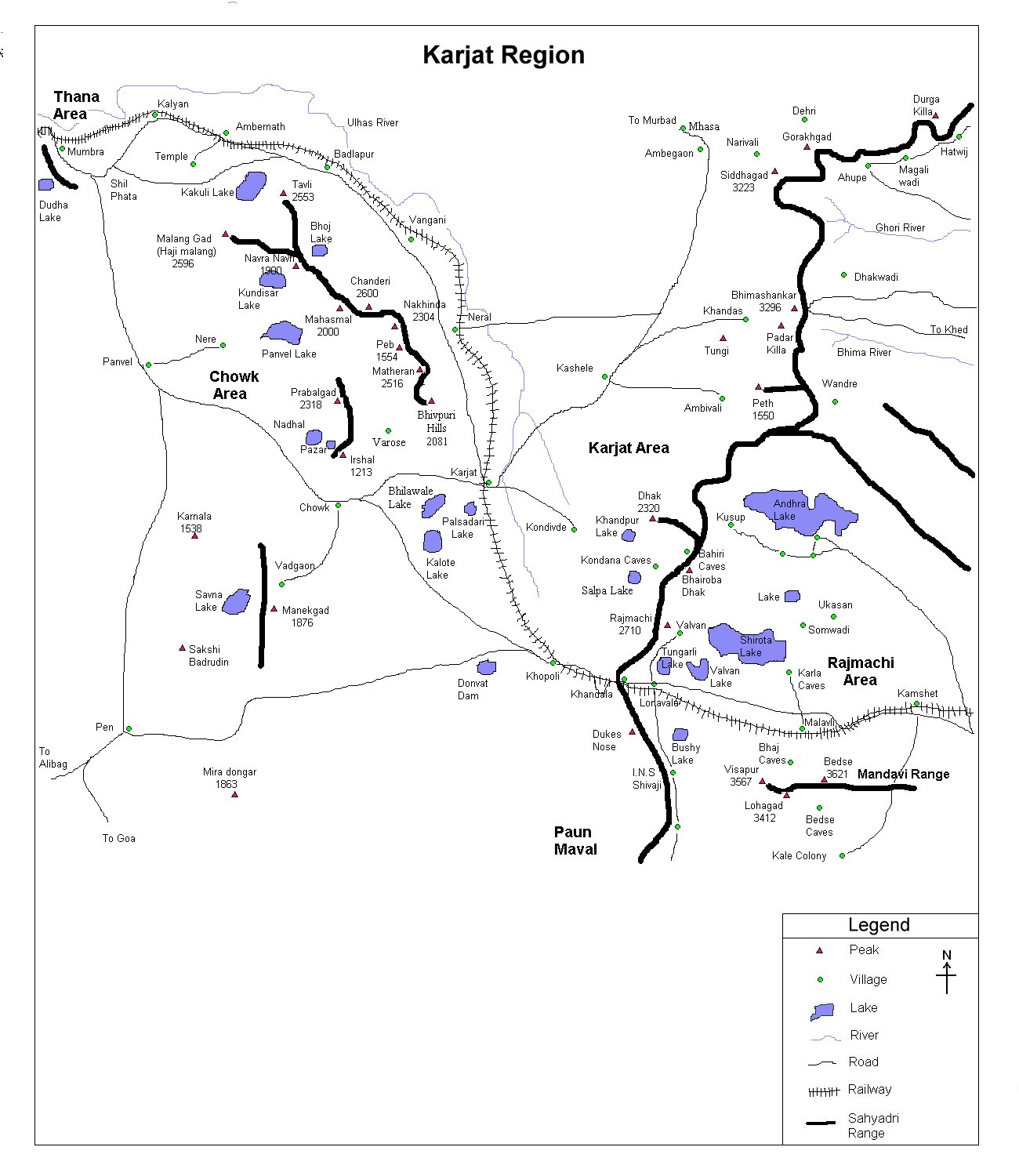
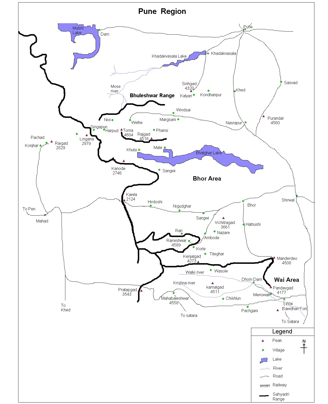
Also known as Rudramal, his fort is adjacent is a famous fort - Purandar and shares a common base. It is located on Narayanpur-Saswad road. Narayanpur is about 40 km from Pune on Pune-Satara road.
|
| |
| Precaution |
Though Vajragad has many 3-4 cisterns, they don't
hold potable water, especially in summer. So better to take enough
water from base village itself.
|
| |
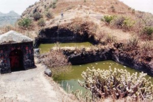
| Sight Seeing |
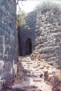
We enter the fort through this nice darwaja.
Fort has 3-4 water cisterns, a Hanuman mandir and a ancient remnant
below ground level with a staircase (covered with mud
though).
|
| |
| Note |
| All references regarding duration
of trek and transport are given with respect to Kalyan, which is
about 50 km north-east of Mumbai. |
| Contact |
| cdeepan@gmail.com Deepan Ashok Choudhary |
| abhijit.avalaskar@gmail.com Abhijit Ulhas Avalaskar |
| Last updated on : 1st Dec 2005 |
