| Mahipatgad
|
| At a Glance |
| Trek |
Mahipatgad |
| Alias |
- |
| Type |
Hill Fort |
| District |
Ratnagiri |
| Height above mean sea
level |
3100 ft (945 m) |
| Base
Village |
Dahivali |
| Minimum
Duration |
2 days |
| Region |
-- |
| Transport |
Kalyan - Khed (road/rail, ~ 200 km)
- Dahivali (road, 25 km) |
| Time to
reach the top |
About 4
hrs from Dahivali |
| Water
Availability |
At the top in front of Mandir |
| Best
season to visit |
November to
February |
| Sights to
visit |
Mandir, water tank, remnants |
| Difficulty Rating |
Simple |
| Shelter |
Mandir | |
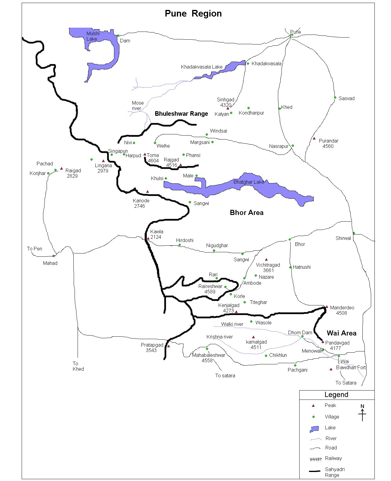
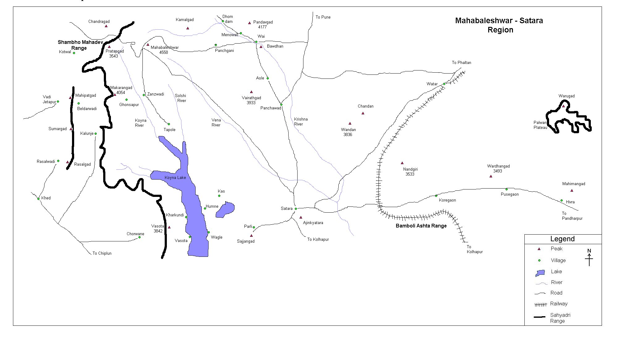
| Location |
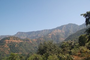
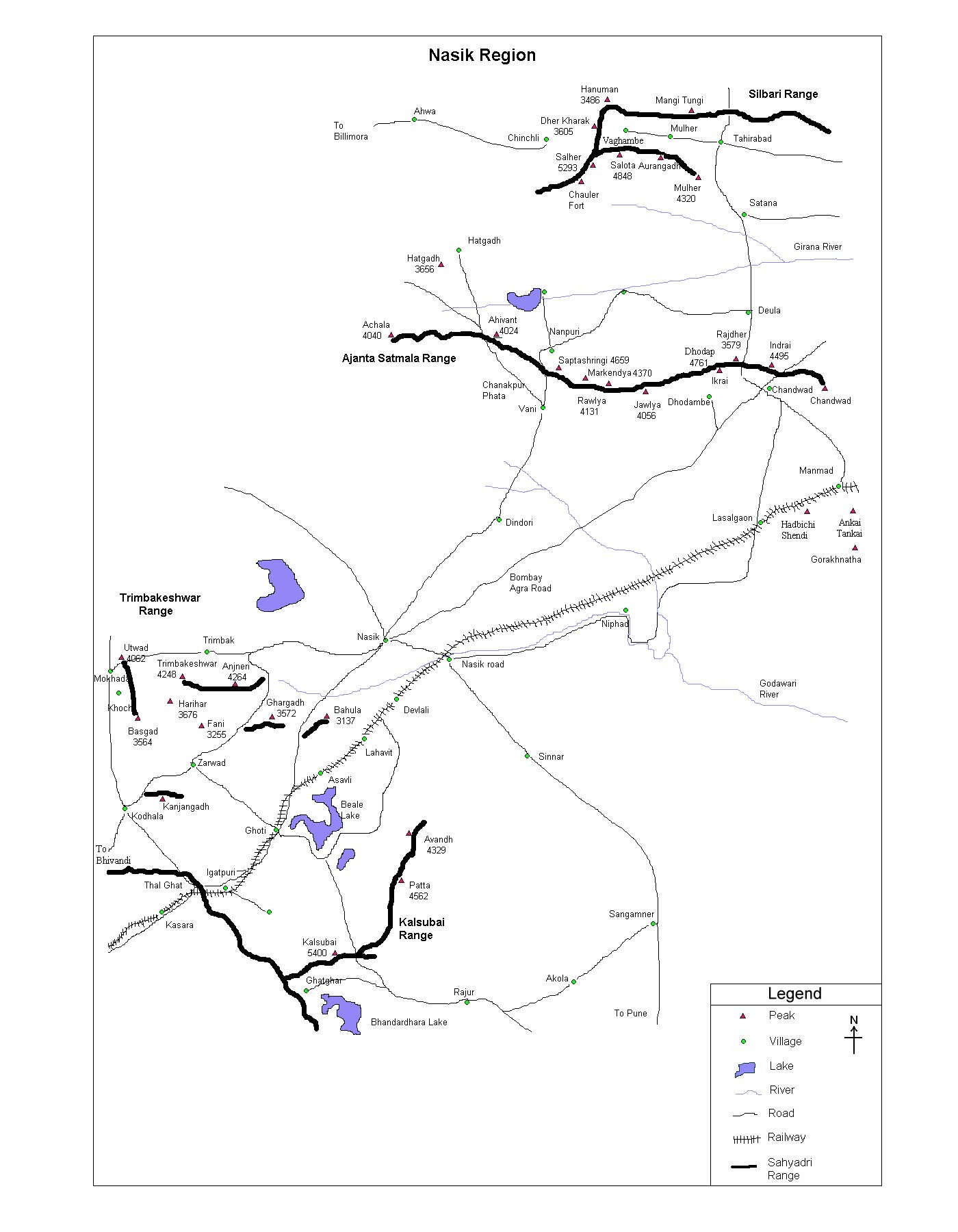
Mahipat is situated east of Khed. One has to reach Khed by
road or rail (~200 km). From Khed, one has to
reach Dahivali by road.From Dahivali, Mahipat top is about 4 hrs
trek
|
| |
| Precaution |
| Fort has dense forest at the
top. Finding the fort structures/ remnants cold be a big fight if
you don't have proper map or a guide. Better to.
take guide from the base who knows the fort well.
|
| |
| Sight Seeing |
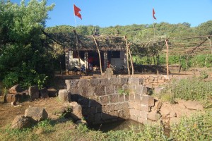
Mandir is in good condition and about 20-25
people can easily stay. Tank seen in the snap hold
water which might need a bit of filtering using a cotton
cloth. |
| |
| |
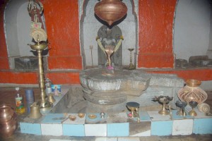
Pareshwar mahadev mandir |
| |
| Note |
| All references regarding duration
of trek and transport are given with respect to Kalyan, which is
about 50 km north-east of Mumbai. |
| Contact |
| cdeepan@gmail.com Deepan Ashok Choudhary |
| abhijit.avalaskar@gmail.com Abhijit Ulhas Avalaskar |
| Last updated on : 1st Dec 2005 |
