| Jivdhan |
| At a Glance |
| Trek |
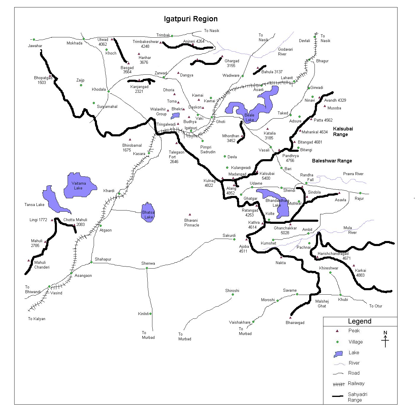
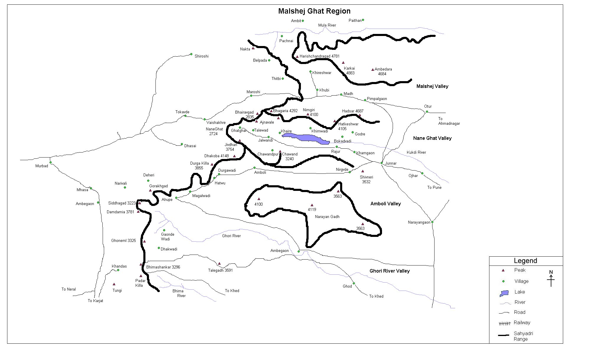
Jivdhan |
| Alias |
- |
| Type |
Hill Fort |
| District |
Pune |
| Height above mean sea level |
~ 3750 ft (~1143 m) |
| Base Village |
Ghatghar |
| Minimum Duration |
2 Days |
| Region |
Malshej ghat |
| Transport |
By bus reach Vaishakhare.
Climb up the Naneghat (~ 3 hrs from Vaishakhare.
See Naneghat page). Walk to the village Ghatghar (~ 1 hr).
Climb up the fort (~ 1 1/2 hr) OR reach Junnar (~125 km) - Ghatghar (~ 30 km).
|
| Time to reach the top |
About 1 1/2 hr from Ghatghar |
| Water Availability |
Water cisterns are available at the
top |
| Best season to visit |
October to February |
| Sights to visit |
Water tanks, granary, remnants, Kalyan darwaja. |
| Difficulty Rating |
Medium |
| Shelter |
No proper shelter at the top. Come people
could find granary suitable but it's too dark in the
granary. Stay can be made in Ghatghar. |
|
| Location |
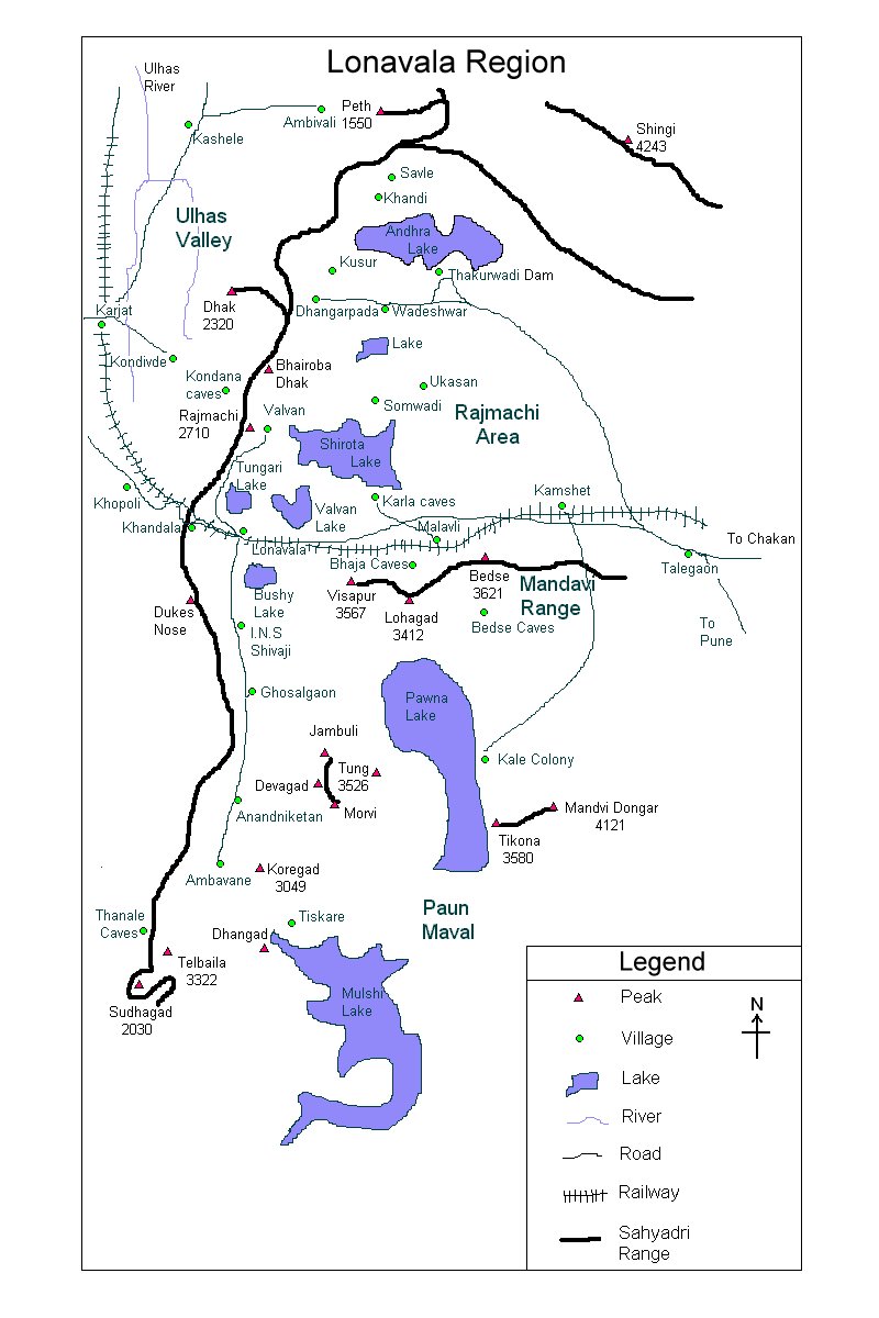
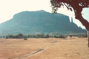 Jivdhan
is situated in the vicinity of Naneghat. Of the 4 guards of
Naneghat, Jivdhan is closest to Naneghat (Hadsar, Chavand, Shivneri
being other 3 forts). One can trek it from Kokan side through
Naneghat (refer Naneghat) and then reach the
base village of Jivdhan - Ghatghar. OR one can directly
reach Ghatghar by road via Junnar. Jivdhan
is situated in the vicinity of Naneghat. Of the 4 guards of
Naneghat, Jivdhan is closest to Naneghat (Hadsar, Chavand, Shivneri
being other 3 forts). One can trek it from Kokan side through
Naneghat (refer Naneghat) and then reach the
base village of Jivdhan - Ghatghar. OR one can directly
reach Ghatghar by road via Junnar. |
| |
| Precaution |
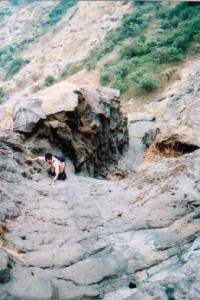
If you trek from Ghatghar side, there is a rock patch at the end.
It's not very difficult and also isn't not exposed. but still one
should be careful.
|
| |
| Sight Seeing |
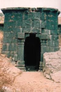
Fort has water cisterns, granary, Kalyan darwaja etc. Naneghat
looks fantastic from the Kalyan darwaja side.
|
| |
| |
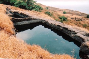
Water cistern has water even in summer |
| |
Note |
| All
references regarding duration of trek and transport are given with respect to Kalyan, which
is about 50 km north-east of Mumbai. |
| Contact |
| cdeepan@gmail.com Deepan Ashok Choudhary |
| abhijit.avalaskar@gmail.com Abhijit Ulhas Avalaskar |
| Last updated on : 1st Dec 2005 |

