
| Home | Maps | Trekking Material | Forts |
| Maps |
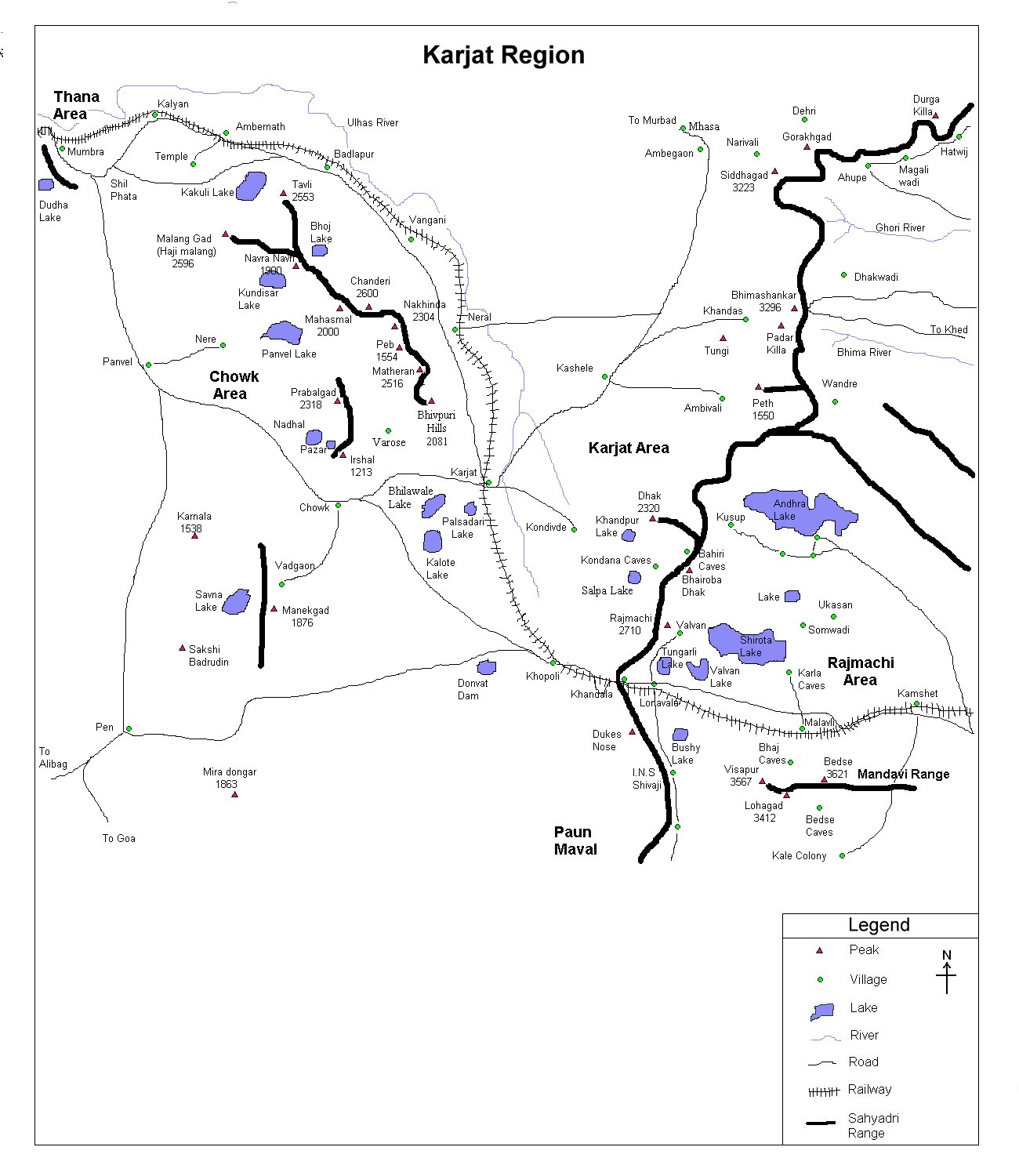
| Karjat Region |
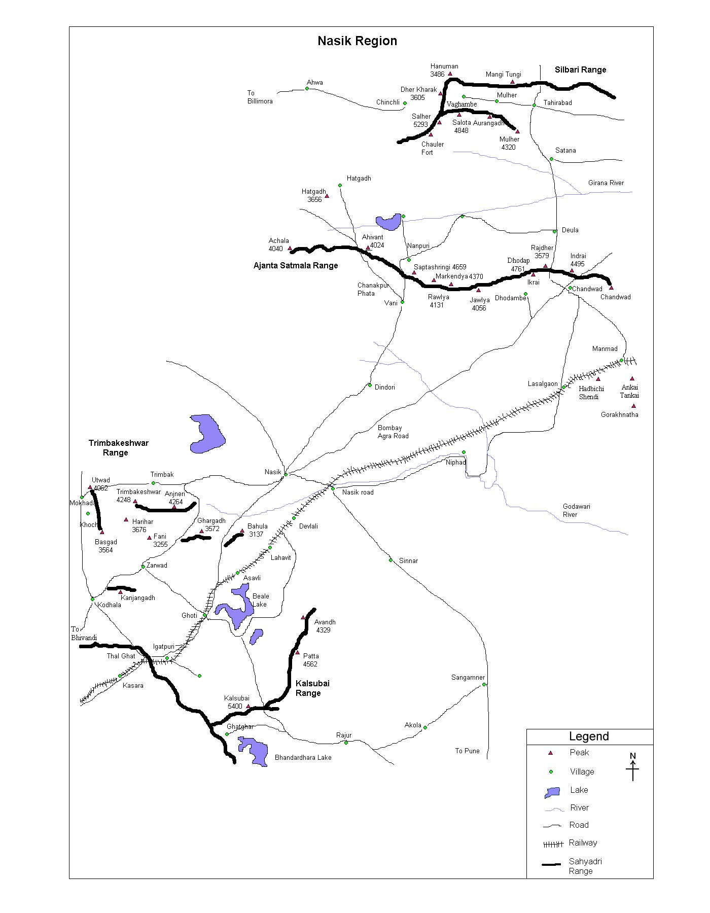
| Nasik Region |
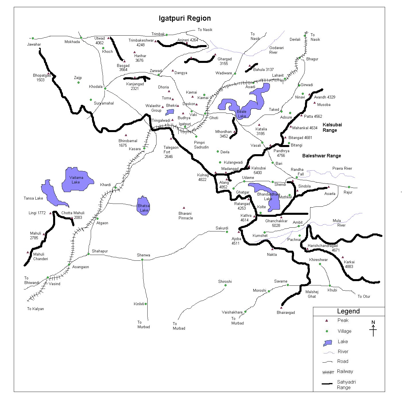
| Igatpuri Region |
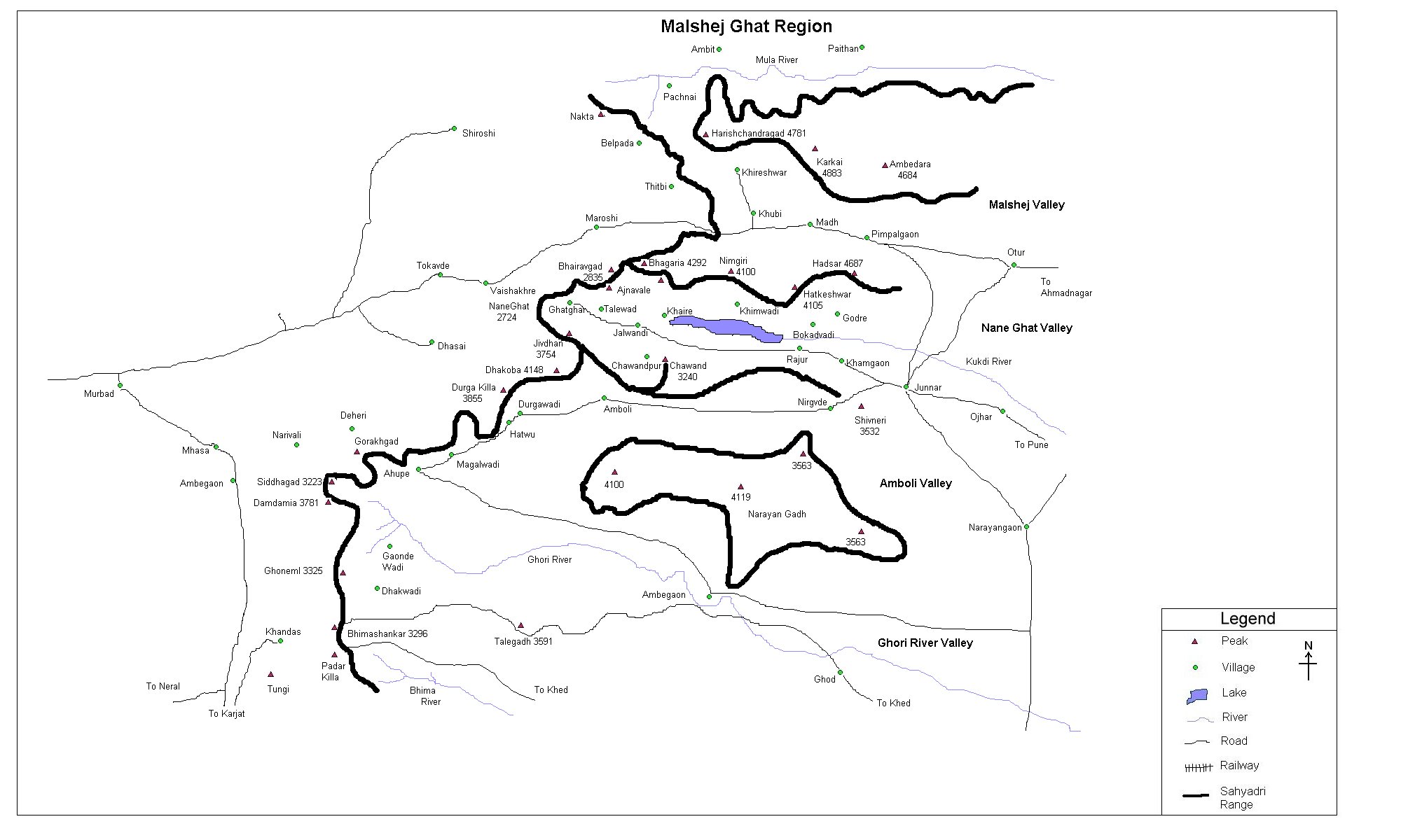
| Malshej Ghat Region |
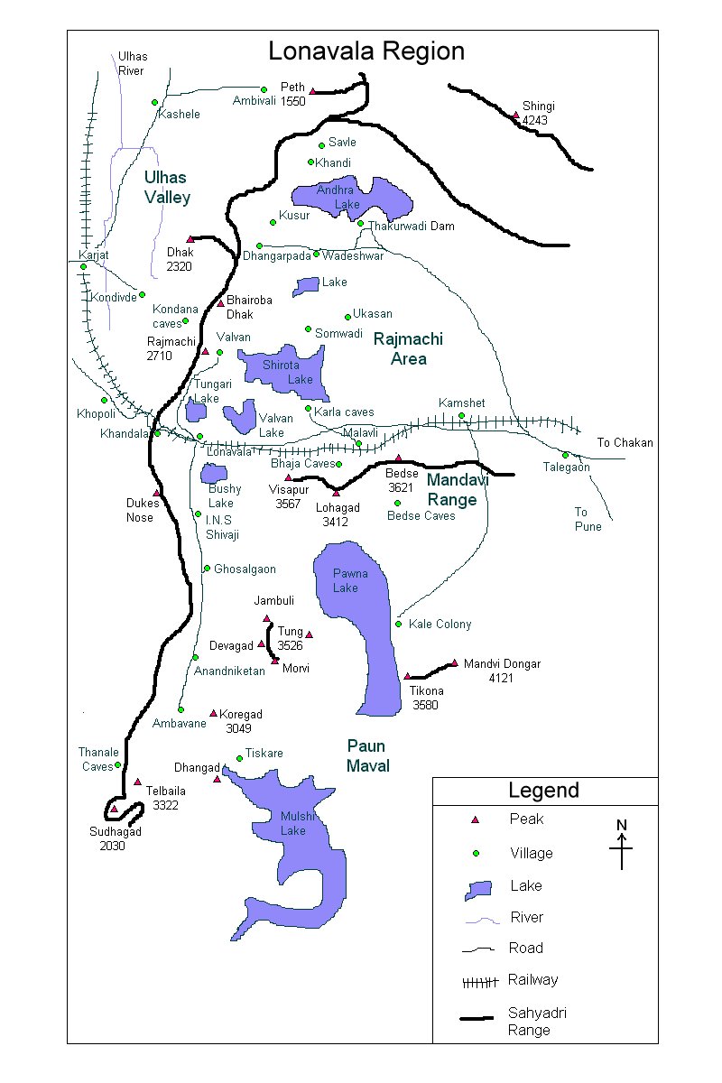
| Lonavala Region |
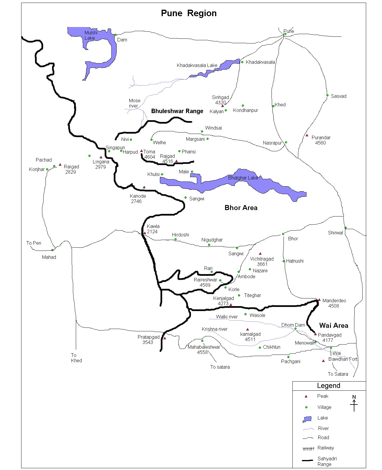
| Pune Region |
| Satara Region |
| Trekking |
| Material |
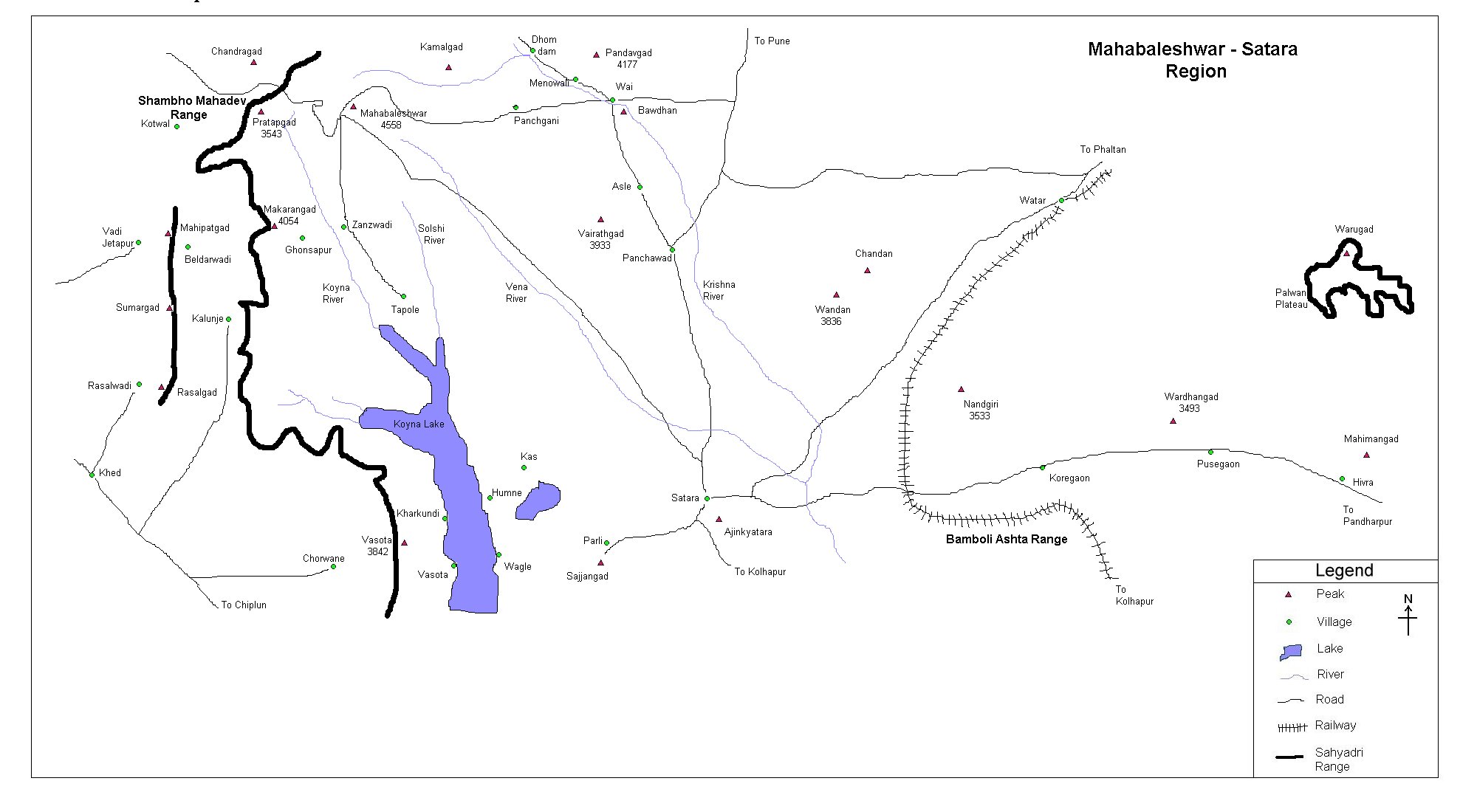
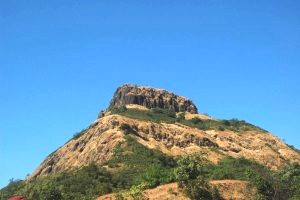
| Sumargad | ||||||||||||||||||||||||||||||
| At a Glance | ||||||||||||||||||||||||||||||
| ||||||||||||||||||||||||||||||
| Location | ||||||||||||||||||||||||||||||
 This is a very small fort in between Mahipatgad and Rasalgad. One can first trek Mahipatgad (Please refer Mahipatgad ) and then visit Sumargad OR first visit Rasalgad (Please refer Rasalgad) and then visit Sumargad. | ||||||||||||||||||||||||||||||
| Precaution | ||||||||||||||||||||||||||||||
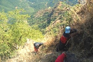 Last 15-20 feet of the trek is a bit tough, especially for novices and should be done with care.. | ||||||||||||||||||||||||||||||
| Sight Seeing | ||||||||||||||||||||||||||||||
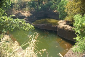 Fort is very small and doesn't hold any significant structures. Water cistern lies on the fort and has good, potable water. Fort offers wonderful view of Makarandgad and Chakdev. | ||||||||||||||||||||||||||||||
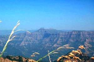 Makarandgad from Sumargad | ||||||||||||||||||||||||||||||
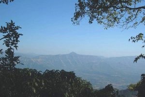 Chakdev from Sumargad | ||||||||||||||||||||||||||||||
| Note | ||||||||||||||||||||||||||||||
| All references regarding duration of trek and transport are given with respect to Kalyan, which is about 50 km north-east of Mumbai. | ||||||||||||||||||||||||||||||
| Contact | ||||||||||||||||||||||||||||||
| cdeepan@gmail.com Deepan Ashok Choudhary | ||||||||||||||||||||||||||||||
| abhijit.avalaskar@gmail.com Abhijit Ulhas Avalaskar | ||||||||||||||||||||||||||||||
| Last updated on : 1st Dec 2005 |