
| Home | Maps | Trekking Material | Forts |
| Maps |
| Karjat Region |
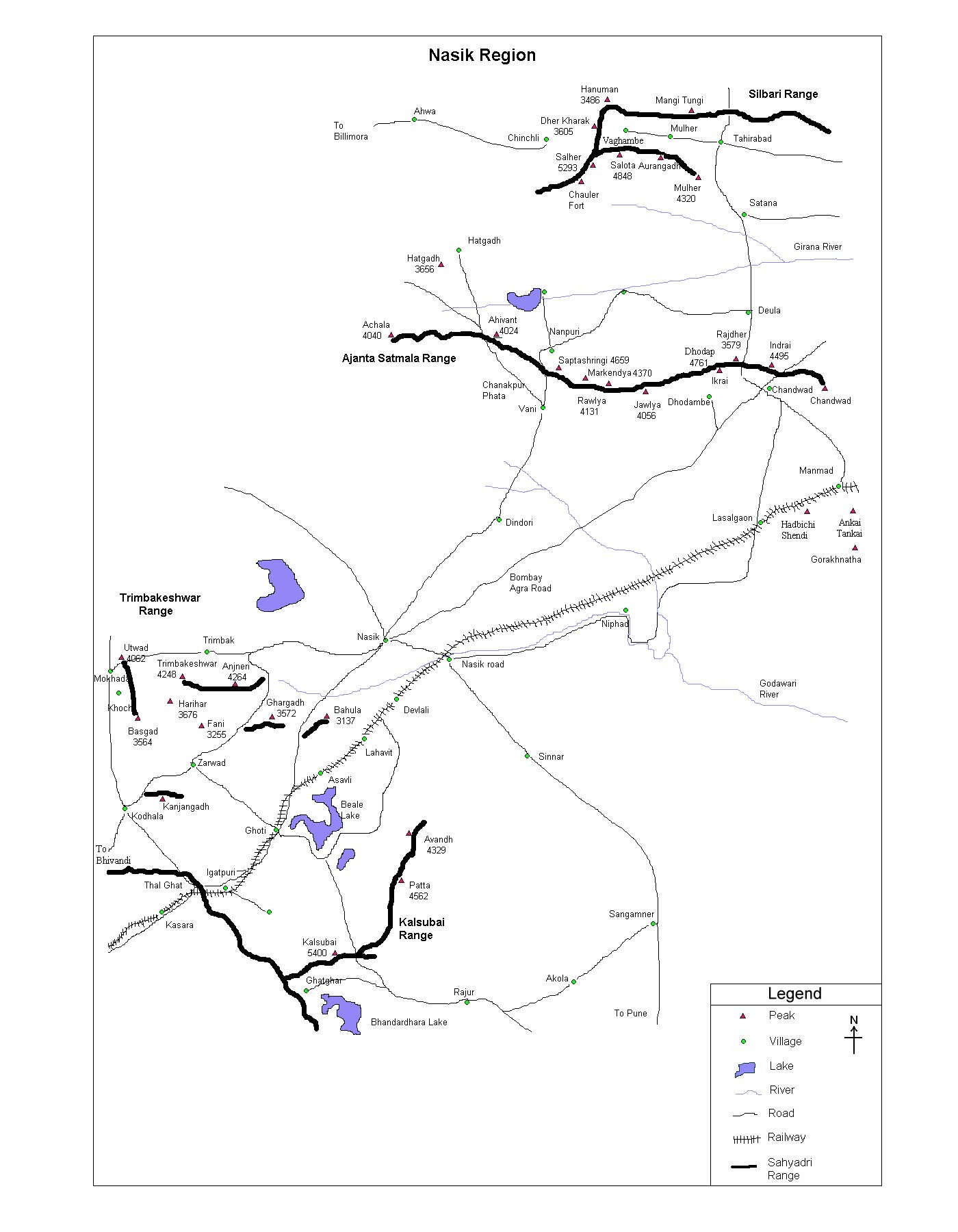
| Nasik Region |
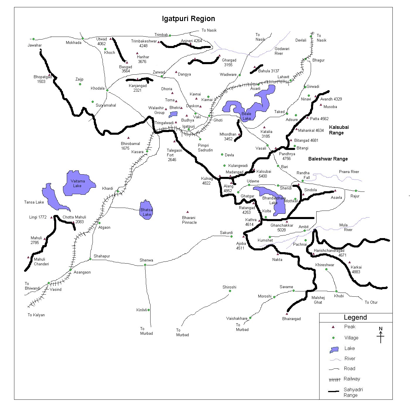
| Igatpuri Region |
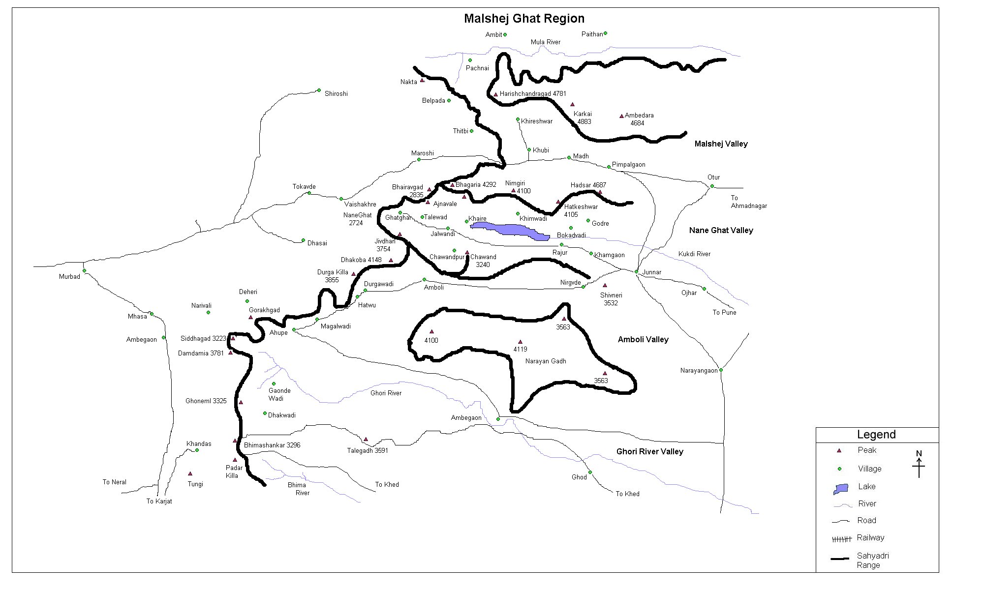
| Malshej Ghat Region |
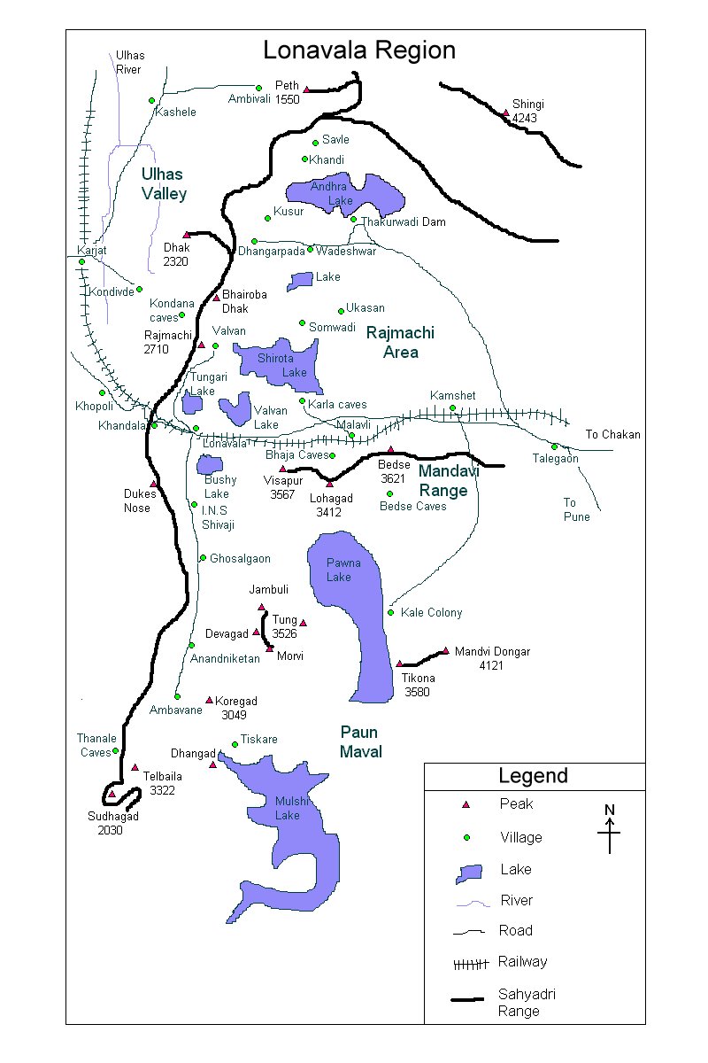
| Lonavala Region |
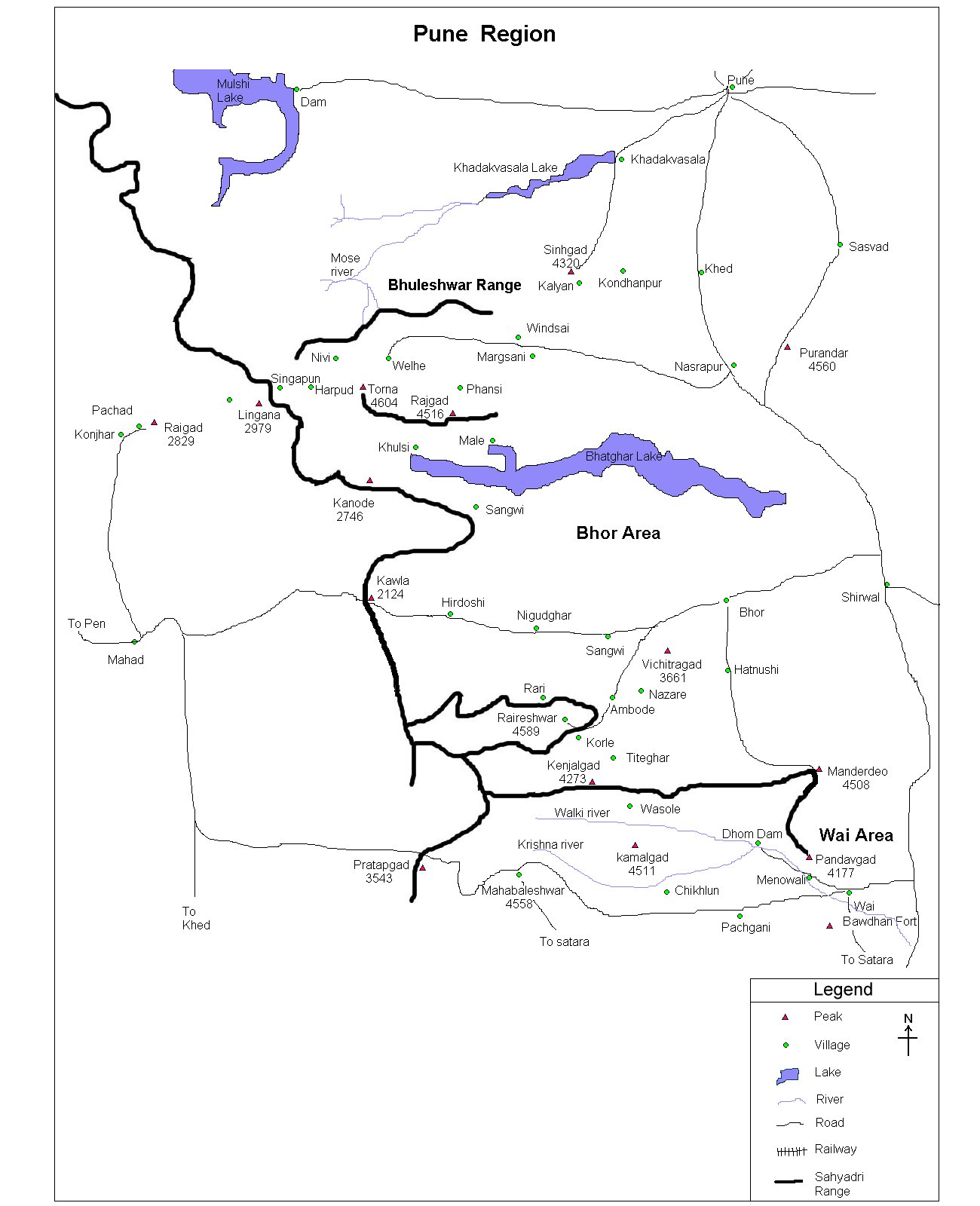
| Pune Region |
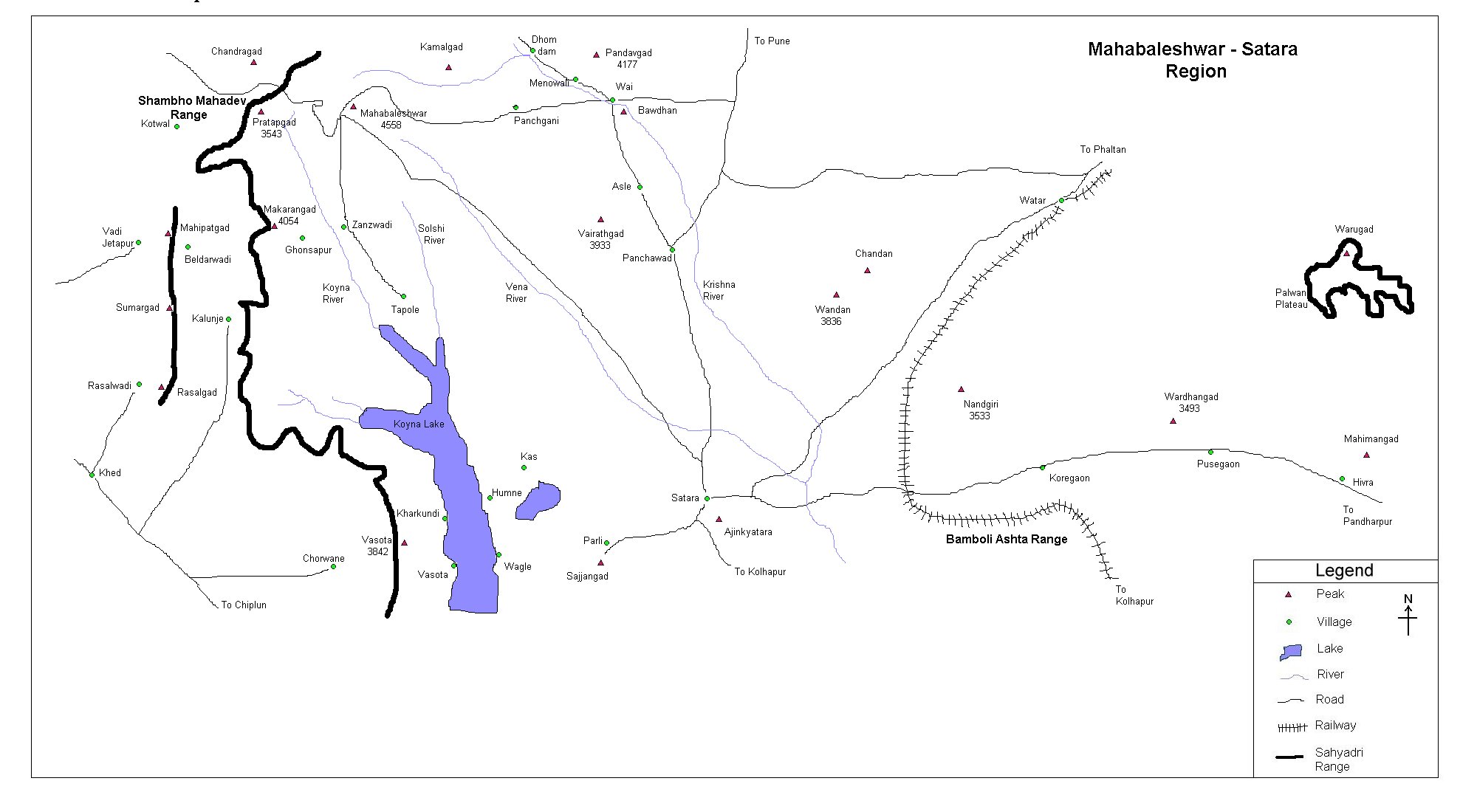
| Satara Region |
| Trekking |
| Material |
| Salher | ||||||||||||||||||||||||||||||
| At a Glance | ||||||||||||||||||||||||||||||
| ||||||||||||||||||||||||||||||
| Location | ||||||||||||||||||||||||||||||
|
| ||||||||||||||||||||||||||||||
| Precaution | ||||||||||||||||||||||||||||||
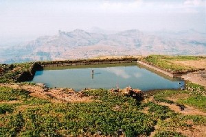 1. Water could be a big problem
until you reach the top, especially in the summer when temperature
reaches at its high level. So, have your bottles full of water from
base village itself. Once you reach the top, a small water cistern
(not the big water tank as shown in the snap) provides you potable
water. 1. Water could be a big problem
until you reach the top, especially in the summer when temperature
reaches at its high level. So, have your bottles full of water from
base village itself. Once you reach the top, a small water cistern
(not the big water tank as shown in the snap) provides you potable
water.
2. Don't drink water from the big water tank (see snap). It's meant for the cows and buffalos. 3. Flies could be troublesome at times. So just be careful. | ||||||||||||||||||||||||||||||
| Sight Seeing | ||||||||||||||||||||||||||||||
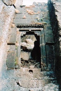
1. Salher has a great, rocky staircase and it's a real joy to watch it from Salota. Having walked the staircase, the big darwaja comes in front. Opposite to the darwaja is a rock carved script. 2. Parashuram mandir is situated on a hillock (about 30 min. from cave). It's the highest point of the fort. | ||||||||||||||||||||||||||||||
| Note | ||||||||||||||||||||||||||||||
| All references regarding duration of trek and transport are given with respect to Kalyan, which is about 50 km north-east of Mumbai. | ||||||||||||||||||||||||||||||
| Contact | ||||||||||||||||||||||||||||||
| cdeepan@gmail.com Deepan Ashok Choudhary | ||||||||||||||||||||||||||||||
| abhijit.avalaskar@gmail.com Abhijit Ulhas Avalaskar | ||||||||||||||||||||||||||||||
| Last updated on : 1st Dec 2005 |
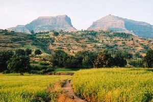 Situated in a wonderful Baglan district
of Nashik at the border of Maharashtra and Gujrat, Salher
takes a pride of the highest fort in Maharashtra and the second
highest peak (after Kalasubai). The Dholbari range in which Salher
is situated and Selbari range is the northernmost part of the
Sahyadri.
Situated in a wonderful Baglan district
of Nashik at the border of Maharashtra and Gujrat, Salher
takes a pride of the highest fort in Maharashtra and the second
highest peak (after Kalasubai). The Dholbari range in which Salher
is situated and Selbari range is the northernmost part of the
Sahyadri.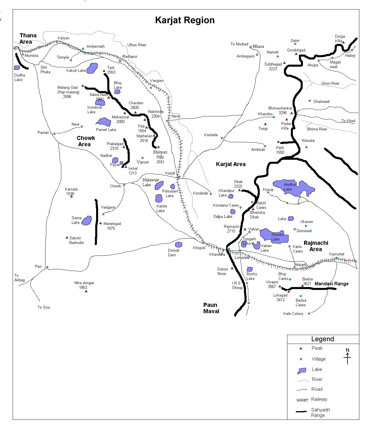