| Bitangad
|
| At a Glance |
| Trek |
Bitangad |
| Alias |
- |
| Type |
Hill Fort |
| District |
Nashik |
| Height above mean sea
level |
3560 ft (1069 m) |
| Base
Village |
Maidara |
| Minimum
Duration |
1 day |
| Region |
Igatpuri |
| Transport |
Kalyan - Kasara - Igatpuri - Ghoti- Taked - Maidara
(Base billage) - Bitanwadi |
| Time to
reach the top |
About 2
hrs from Maidara |
| Water
Availability |
Water cisterns are available but better
to carry water from Bitanwadi which itself is on top. |
| Best
season to visit |
November to
March |
| Sights to
visit |
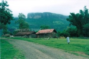
Bitanwadi village near the top of the
fort, Hanuman mandir in Bitanwadi, cave, water cisterns |
| Difficulty Rating |
Simple |
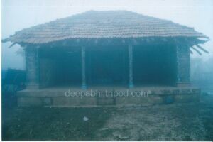
| Shelter |
Cave or Hanuman mandir in
Bitanwadi | |
| Location |
|
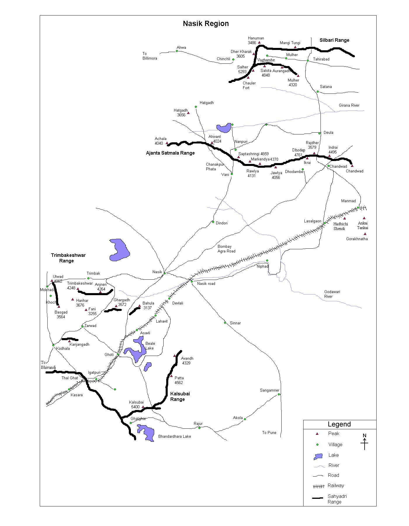
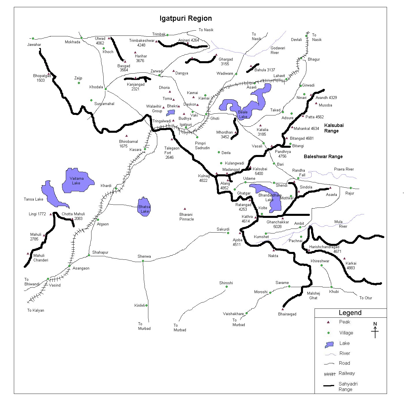
 Bitangad is situated in the
Kalsubai range of Sahyadri near the borders of Nashik and
Ahmadnagar districts. It's surrounded by Avandh, Patta alias Vishramgad, Pandharya, Mahankal
etc
Bitangad is situated in the
Kalsubai range of Sahyadri near the borders of Nashik and
Ahmadnagar districts. It's surrounded by Avandh, Patta alias Vishramgad, Pandharya, Mahankal
etc
|
| |
| Precaution |
|
No special precaution is needed
|
Sight Seeing |
 A small top doesn't hold too many
historical monuments but it offers a great view of mountains in the
Kalsubai range. Bitanwadi village, Hanuman mandir, cave, water
cisterns are the other things one should look for. A small top doesn't hold too many
historical monuments but it offers a great view of mountains in the
Kalsubai range. Bitanwadi village, Hanuman mandir, cave, water
cisterns are the other things one should look for. |
| |
| Note |
| All references regarding duration
of trek and transport are given with respect to Kalyan, which is
about 50 km north-east of Mumbai.. |
| Contact |
| cdeepan@gmail.com Deepan Ashok Choudhary |
| abhijit.avalaskar@gmail.com Abhijit Ulhas Avalaskar |
| Last updated on : 1st Dec 2005 |
