| Makarandgad
|
| At a Glance |
| Trek |
Makarandgad |
| Alias |
Madhumakarand gad |
| Type |
Hill Fort |
| District |
Satara |
| Height above mean sea
level |
4075 ft (1242 m) |
| Base
Village |
Hatlot |
| Minimum
Duration |
2 days |
| Region |
Mahabaleshwar |
| Transport |
Kalyan - Mahad - Poladpur - Hatlot (~ 225 km) |
| Time to
reach the top |
About 2 1/2
hrs from Hatlot |
| Water
Availability |
Potable water is available on the top |
| Best
season to visit |
November to
February |
| Sights to
visit |
Mandir's (temples), water cistern |
| Difficulty Rating |
Simple |
| Shelter |
Mallikarjun Mahadev mandir and Gamdevi mandir |
|
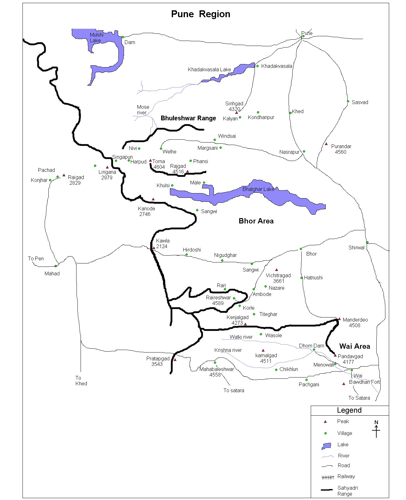
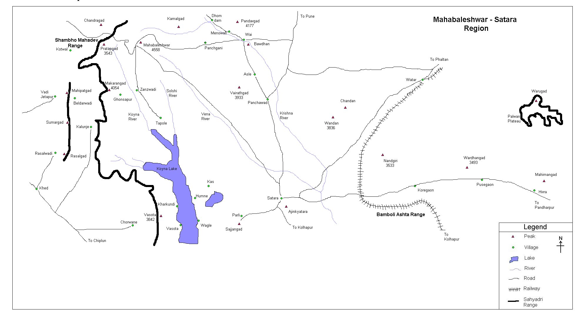
| Location |
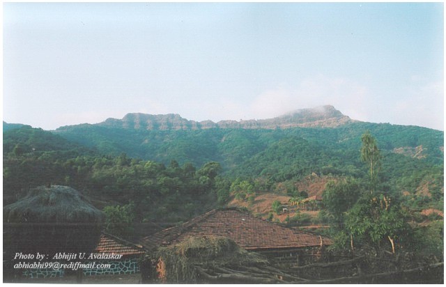
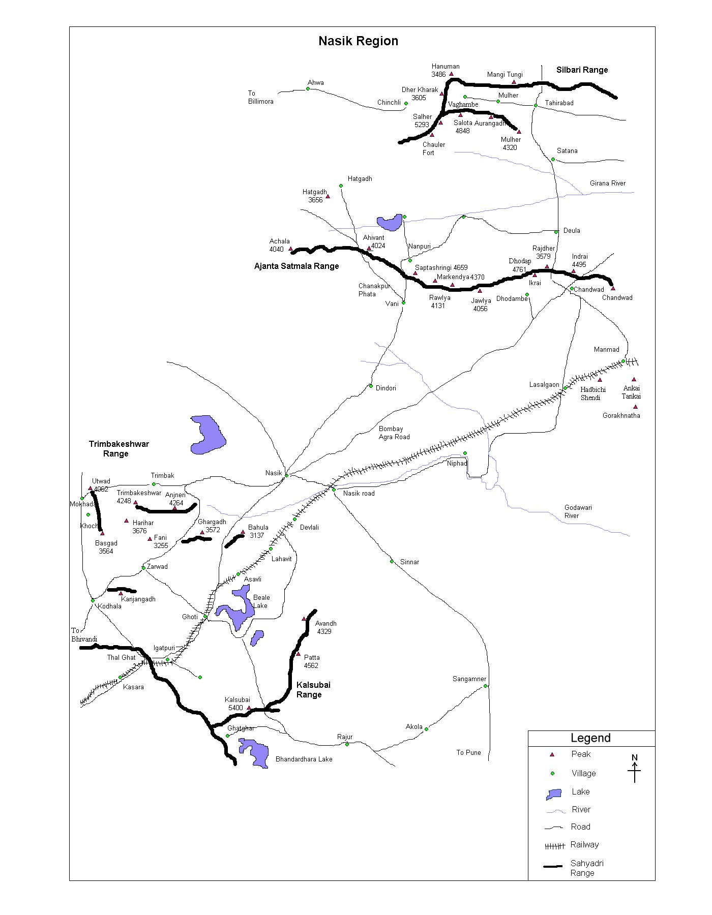
The fort is located in the vicinity of Mahabaleshwar and Pratapgad region. Reaching village Hatlot via
Mahad - Poladpur, one has to trek for about 2
1/2 hrs to reach the mandir at the top if the
fort.
|
| |
| Precaution |
| No special
precaution is needed.
|
| |
| Sight Seeing |
Water from the tank is absolutely nice and clean. This is the only water source available during the trek. |
| |
| |
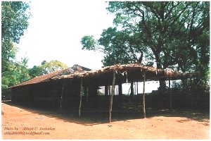
Before reaching the top, one sees this
mandir. Path going straight from mandir leads to
Ghonuspur. One has to take left from (as per the snap) to reach
Makarandad top in about 30 min. |
| |
| Note |
| All references regarding duration
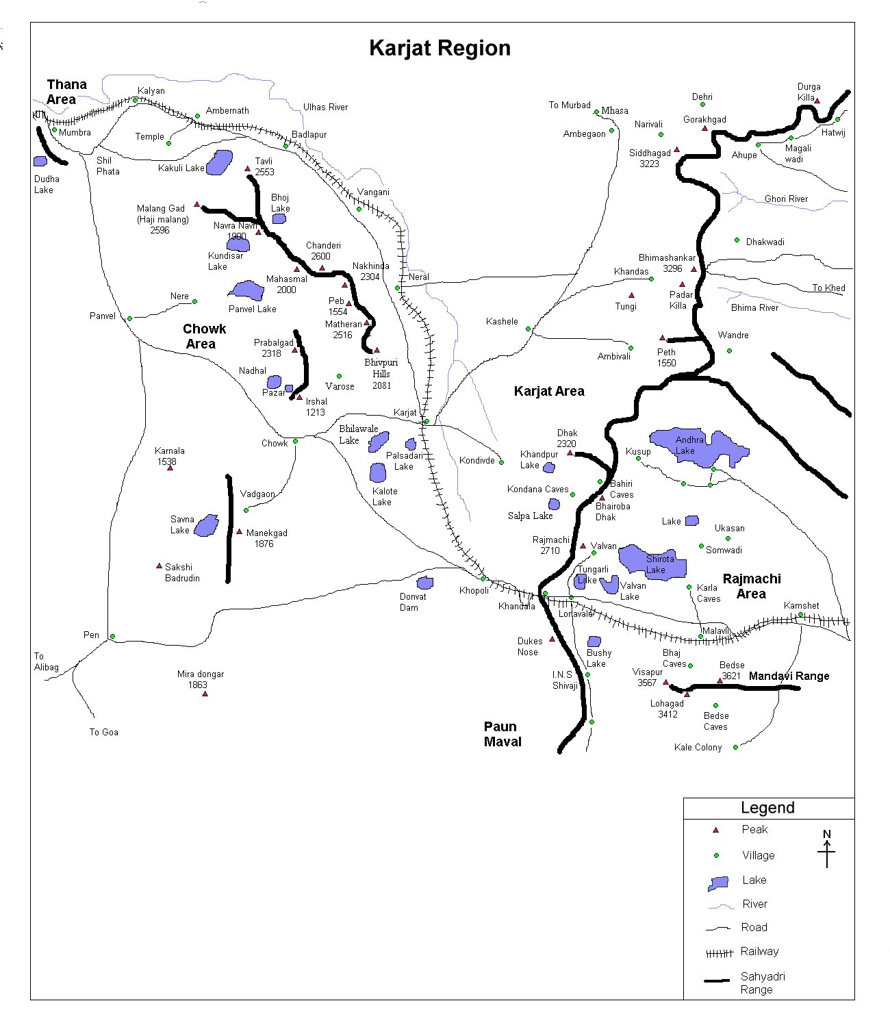
of trek and transport are given with respect to Kalyan, which is
about 50 km north-east of Mumbai. |
| Contact |
| cdeepan@gmail.com Deepan Ashok Choudhary |
| abhijit.avalaskar@gmail.com Abhijit Ulhas Avalaskar |
| Last updated on : 1st Dec 2005 |
