| Sri Malang Gad |
| At a Glance |
| Trek |
Sri Malang
gad |
| Alias |
- |
| Type |
Hill Fort |
| District |
Raigad |
| Height above mean sea level |
2596 feet |
| Nearest Village |
Kalyan |
| Minimum Duration |
1 Day |
| Region |
Karjat |
| Transport |
By Train reach Kalyan. Buses are available from Kalyan to the base of the
fort on a regular basis |
| Time to reach the top |
About 2 hours from the base |
| Water Availability |
Water is available through the small
hotels on the way. Best is to carry your own water from
Kalyan. |
| Best season to visit |
Any season except monsoon |
| Sights to visit |
HajiMalang Dargah,
Maachi and balekilla of the fort. |
| Difficulty Rating |
Reaching maachi is quiet easy but going to balekilla is quiet tough
|
| Shelter |
No shelter is
available |
|
| Location |
|
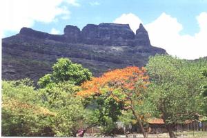
 Situated
at the border of Thane-Raigad districts is
known more for the Dargah of Malang Baba, halfway up
the mountain. But above the Dargah there is a much more hidden
thrill for the trekkers, which one may not expect. Situated
at the border of Thane-Raigad districts is
known more for the Dargah of Malang Baba, halfway up
the mountain. But above the Dargah there is a much more hidden
thrill for the trekkers, which one may not expect.
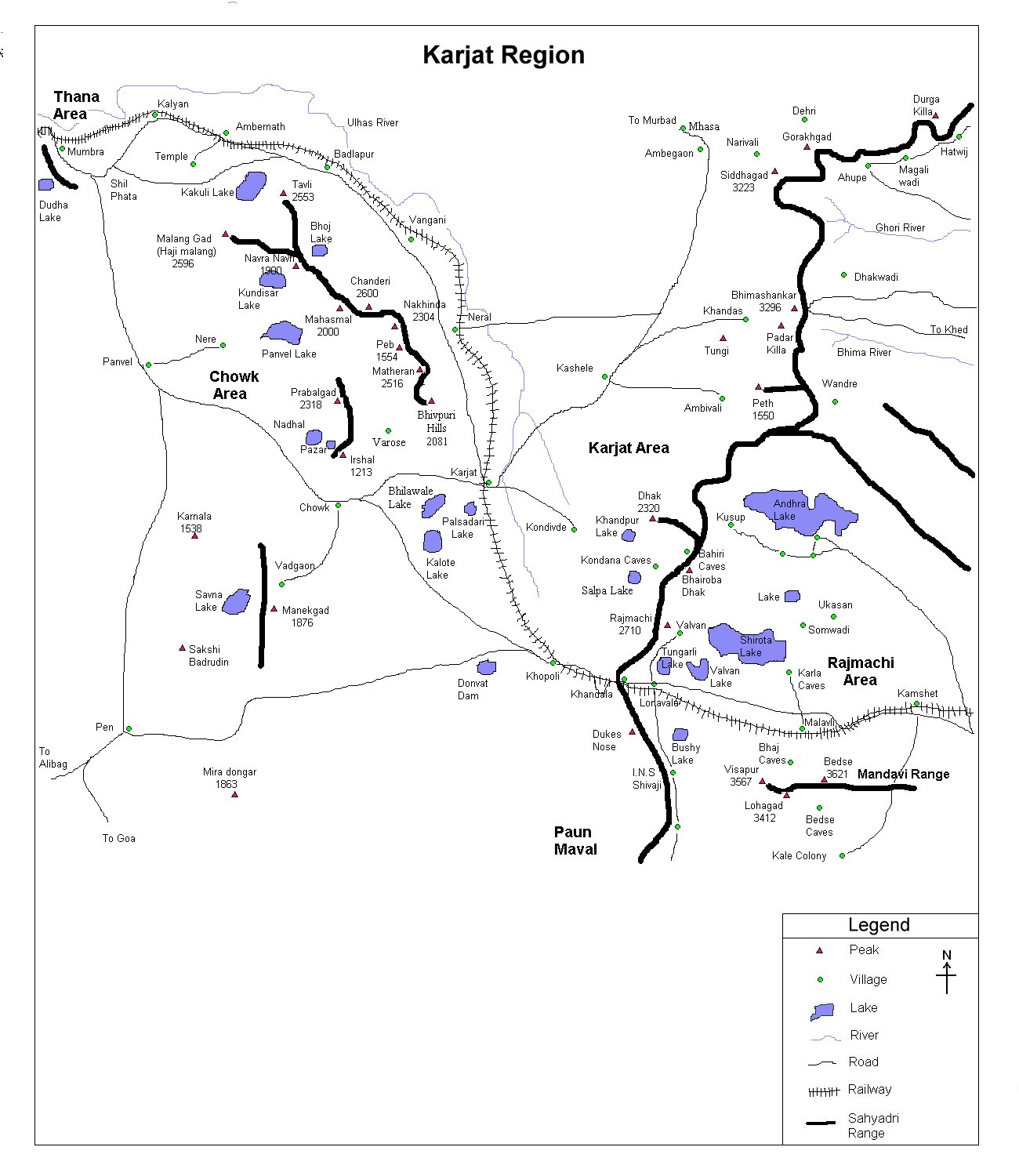
Shri Malang Gad is situated at a distance of
13 K.m. from Kalyan. Kalyan is well connected to Mumbai by rail as
well as road. Frequent S.T. buses are available from Kalyan S.T.
station to the base. About one and half hours climbing by steps will
take you to the Dargah. 20 mins from Dargah up to the mountain will
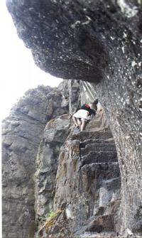
take you to the Balekilla (citadel).
The pinnacle of the Shri Malang Gad is supposed to be the real challenge
for the professional trekkers, but for amateur trekkers reaching the pinnacle by
a very very narrow path should also be a thrilling
experience. |
| |
| Precaution |
 The
way to the Dargah has many exhaustive steps (water is
available throughout from the small hotel's). Beggers on th eway are
irritating. The
way to the Dargah has many exhaustive steps (water is
available throughout from the small hotel's). Beggers on th eway are
irritating. |
| |
| Sight Seeing |
One can visit the Haji Malang dargah on the
way to the fort. From the Balekilla (citadel) we can see Chanderi,
Matheran range to the south, Kalyan city, Mahuli to the north and Mumbai (with part of sea)to the west.
For more photographs
follow this link
|
| |
| Note |
| All references regarding duration of trek and
transport are given with respect to Kalyan |
| Contact |
| cdeepan@gmail.com Deepan Ashok Choudhary |
| abhijit.avalaskar@gmail.com Abhijit Ulhas Avalaskar |
| Last updated on : 1st Dec 2005 |


 The
way to the Dargah has many exhaustive steps (water is
available throughout from the small hotel's). Beggers on th eway are
irritating.
The
way to the Dargah has many exhaustive steps (water is
available throughout from the small hotel's). Beggers on th eway are
irritating.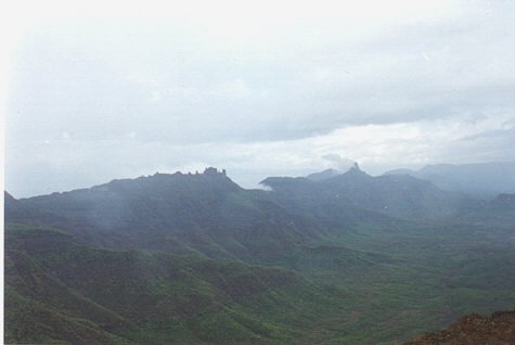