| Chavand |
| At a Glance |
| Trek |
Chavand |
| Alias |
Prasannagad |
| Type |
Hill Fort |
| District |
Pune |
| Height above mean sea level |
3490 ft (1067 m) |
| Base Village |
Chavand |
| Minimum Duration |
2 Days |
| Region |
Junnar |
| Transport |
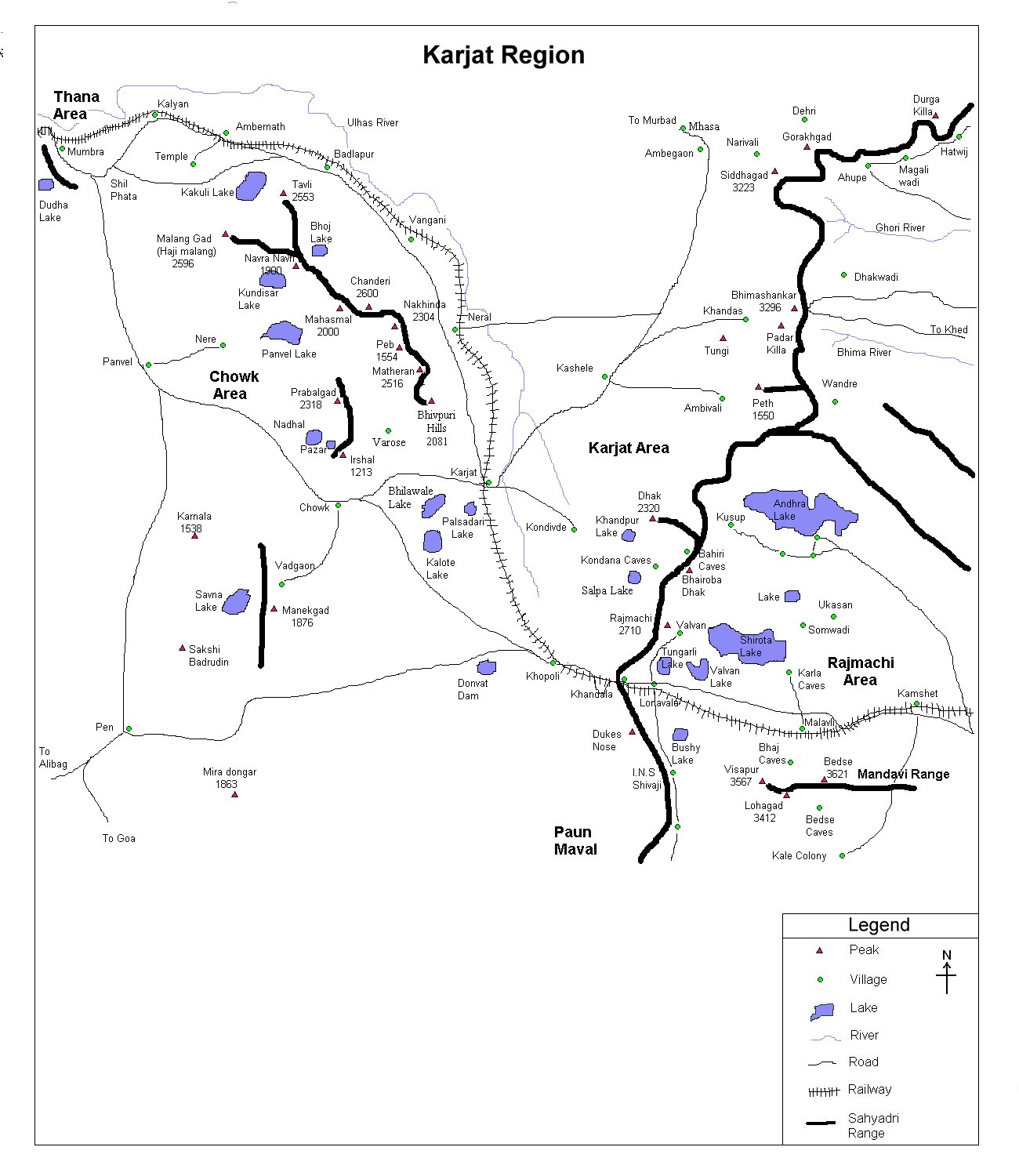
Kalyan to Junnar (road, ~ 125 km) - Chavand (17 km) |
| Time to reach the top |
About 1 1/2 hr from Chavand |
| Water Availability |
Water cisterns are there but water isn't potable |
| Best season to visit |
October to March |
| Sights to visit |
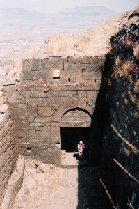
Chavandai temple, water cisterns, Darwaja etc. |
| Difficulty Rating |
Simple |
| Shelter |
No proper shelter at the top, however one may take a shelter in the base village. |
|
| Location |
|
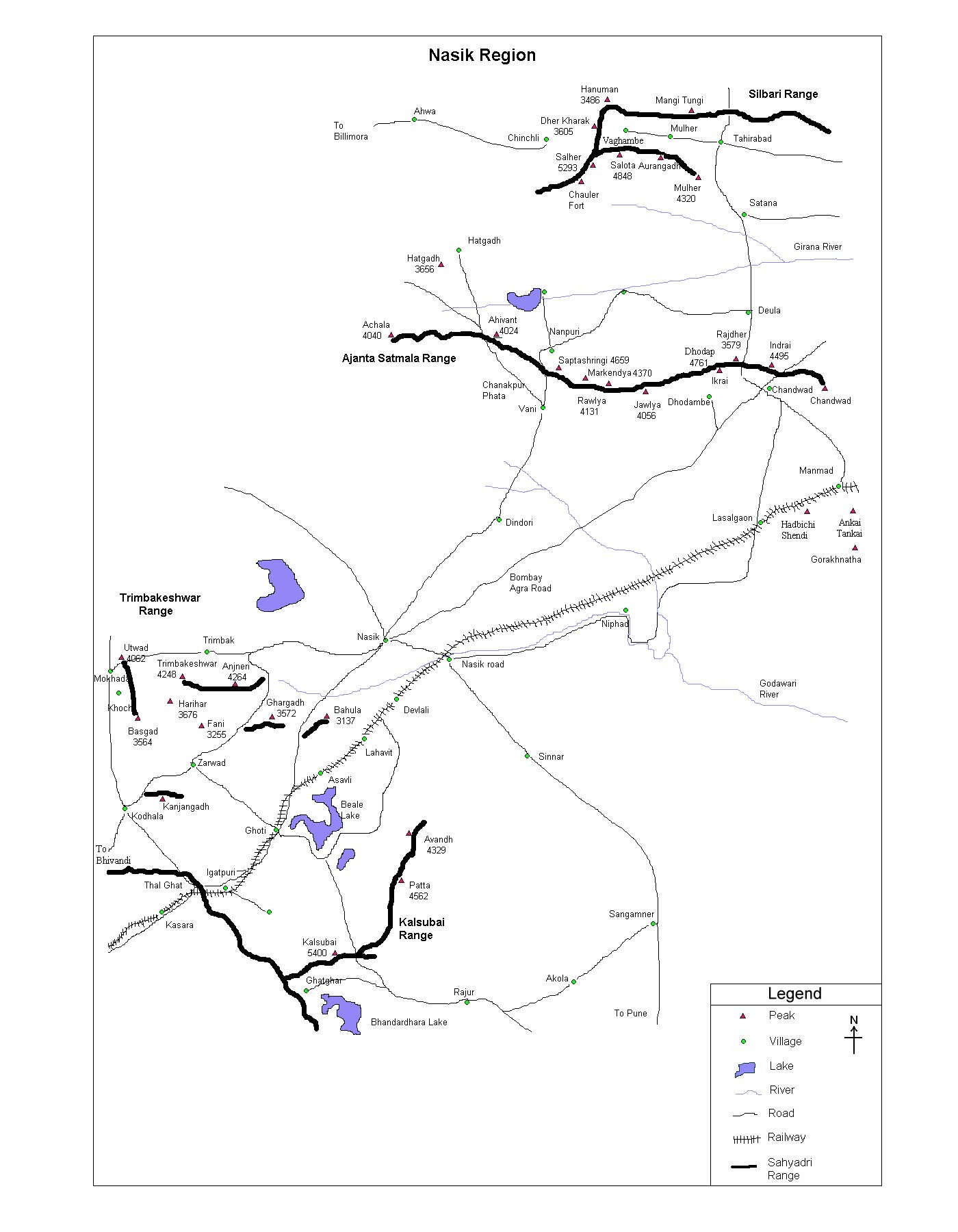
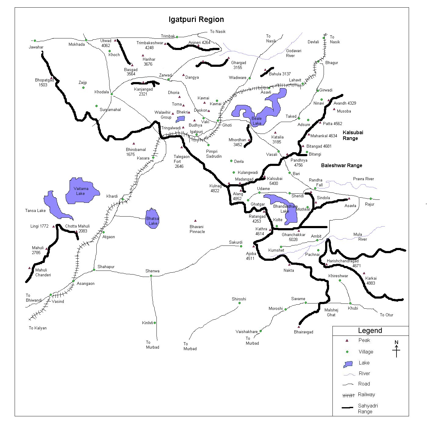
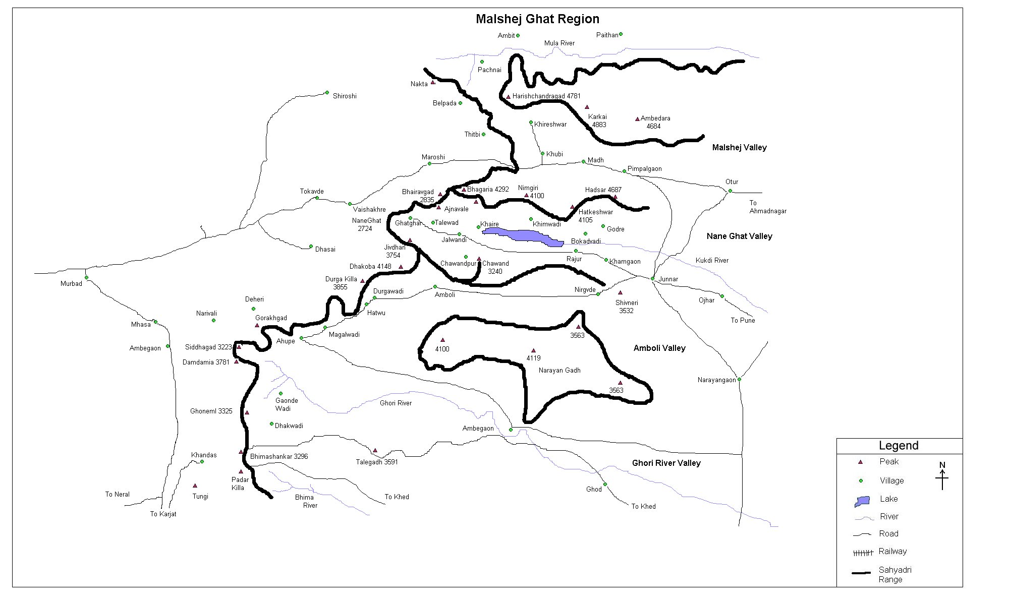
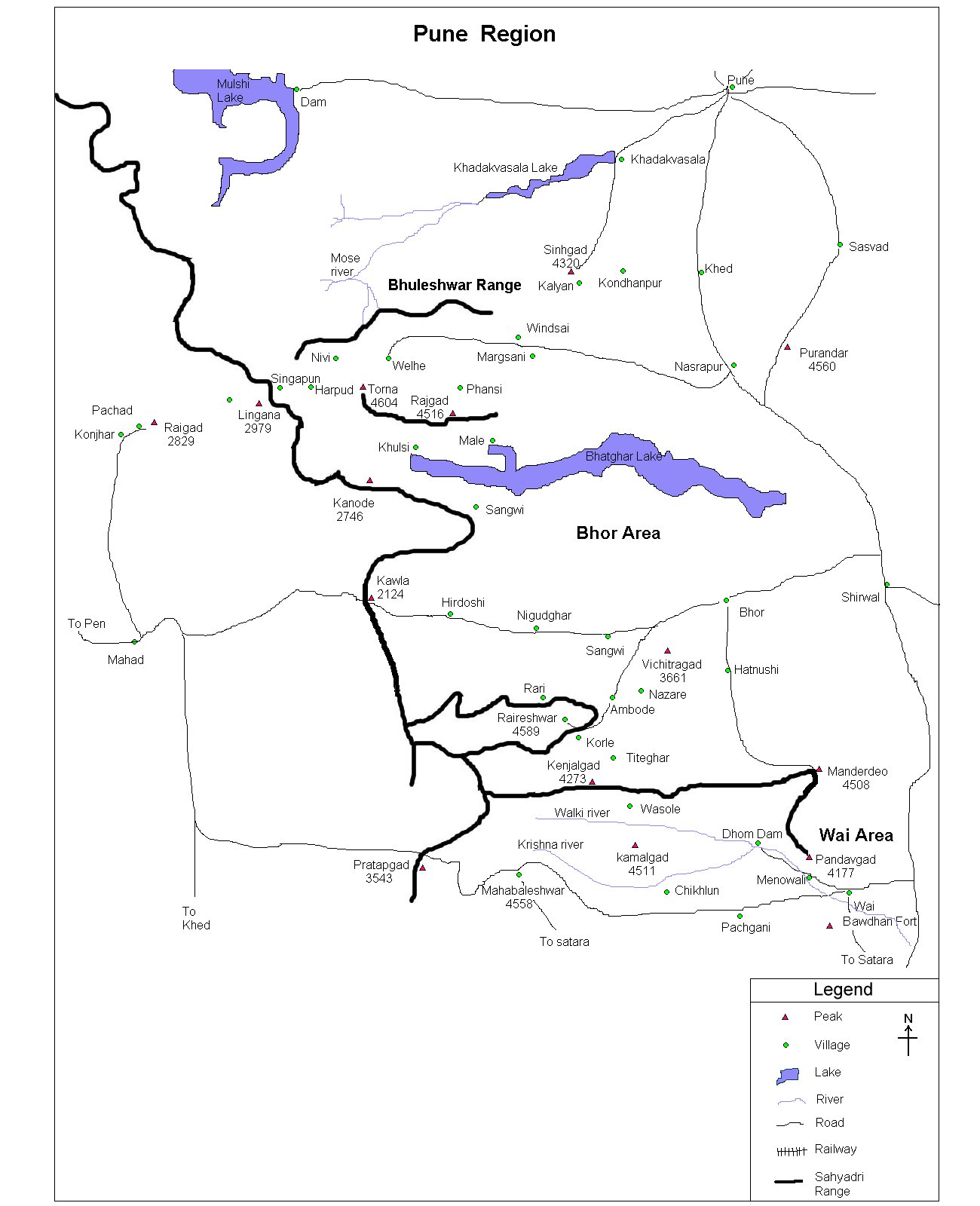
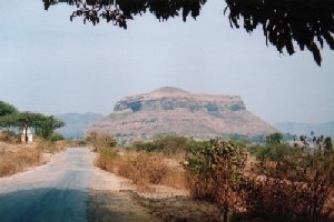 This is one of the 4 forts which guards Naneghat - the ancient trade route between Junnar (plateau) and Kalyan, Nalasopara (both in Konkan). Reaching Junnar, one has to catch bus to reach village Chavand which is only 17 km North-West of Junnar. Reaching the village, walk for about 20-25 mins to reach a school at the base of fort. From here, one can reach the top in a hour This is one of the 4 forts which guards Naneghat - the ancient trade route between Junnar (plateau) and Kalyan, Nalasopara (both in Konkan). Reaching Junnar, one has to catch bus to reach village Chavand which is only 17 km North-West of Junnar. Reaching the village, walk for about 20-25 mins to reach a school at the base of fort. From here, one can reach the top in a hour
|
|
| |
| Precaution |
- Water could be a big problem, especially in the summer season because there isn't any potable water source on the fort.
- Railings on the fort are bit jerky, hence be careful with them.
- The top being a bit grassy, always beware of reptiles.
|
|
| |
| Sight Seeing |
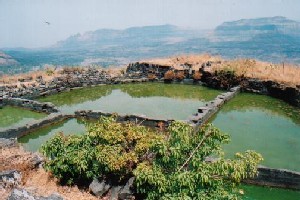 The greatest attraction of this fort is probably 7 big water tanks (saat take)!! Though not potable, this tanks contains ample amount of water even in the summer.
The fort has a one Darwaja (gate) in a good condition. Remnants of a Mahadev temple are found atop and a water tank next to it.
Chavandai temple (~ 10 min from saat take) with a deepmal marks the highest point of the fort. |
| |
| Note |
| All references regarding duration of trek and
transport are given with respect to Kalyan, which is about 50 km north-east of Mumbai. |
| Contact |
| cdeepan@gmail.com Deepan Ashok Choudhary |
| abhijit.avalaskar@gmail.com Abhijit Ulhas Avalaskar |
| Last updated on : 1st Dec 2005 |

