| Bhimashankar |
| At a Glance |
| Trek |
Bhimashakar |
| Alias |
- |
| Type |
Pilgrimage |
| District |
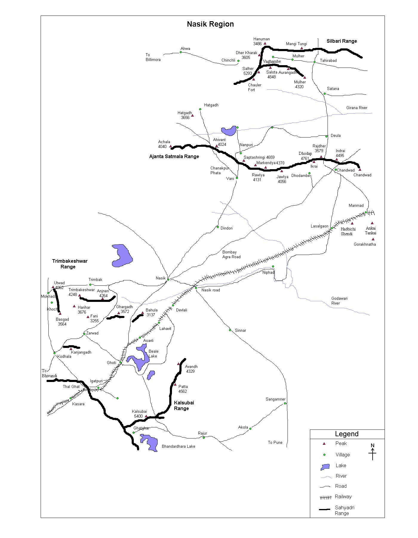
Pune |
| Height above mean sea level |
3296 feet |
| Base Village |
Khandas |
| Minimum Duration |
2 Days |
| Region |
Karjat |
| Transport |
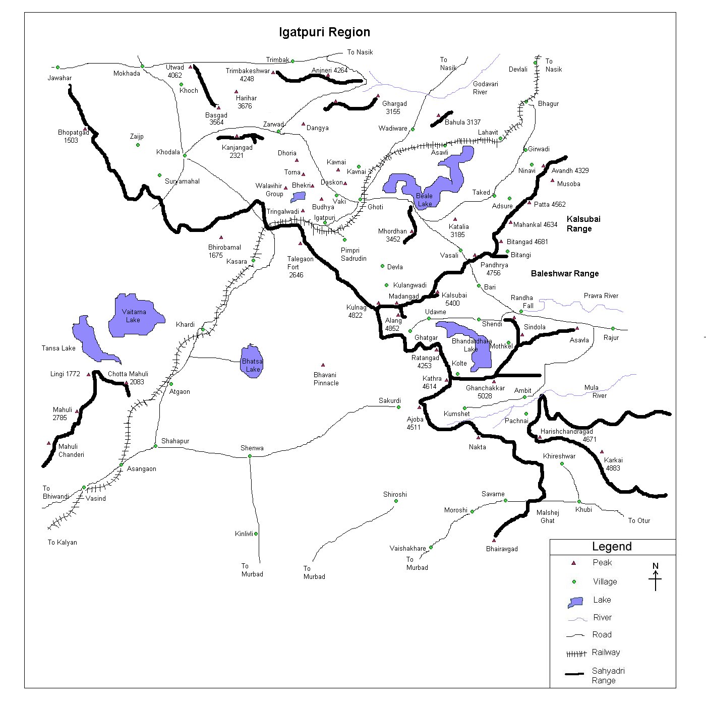
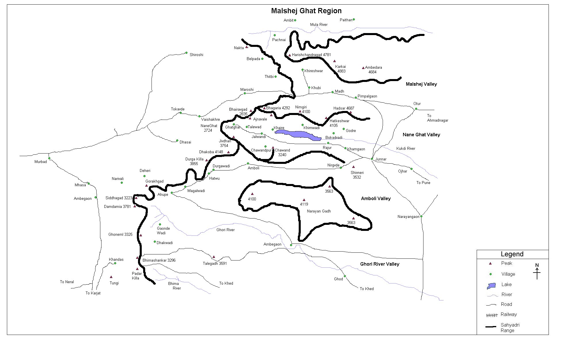
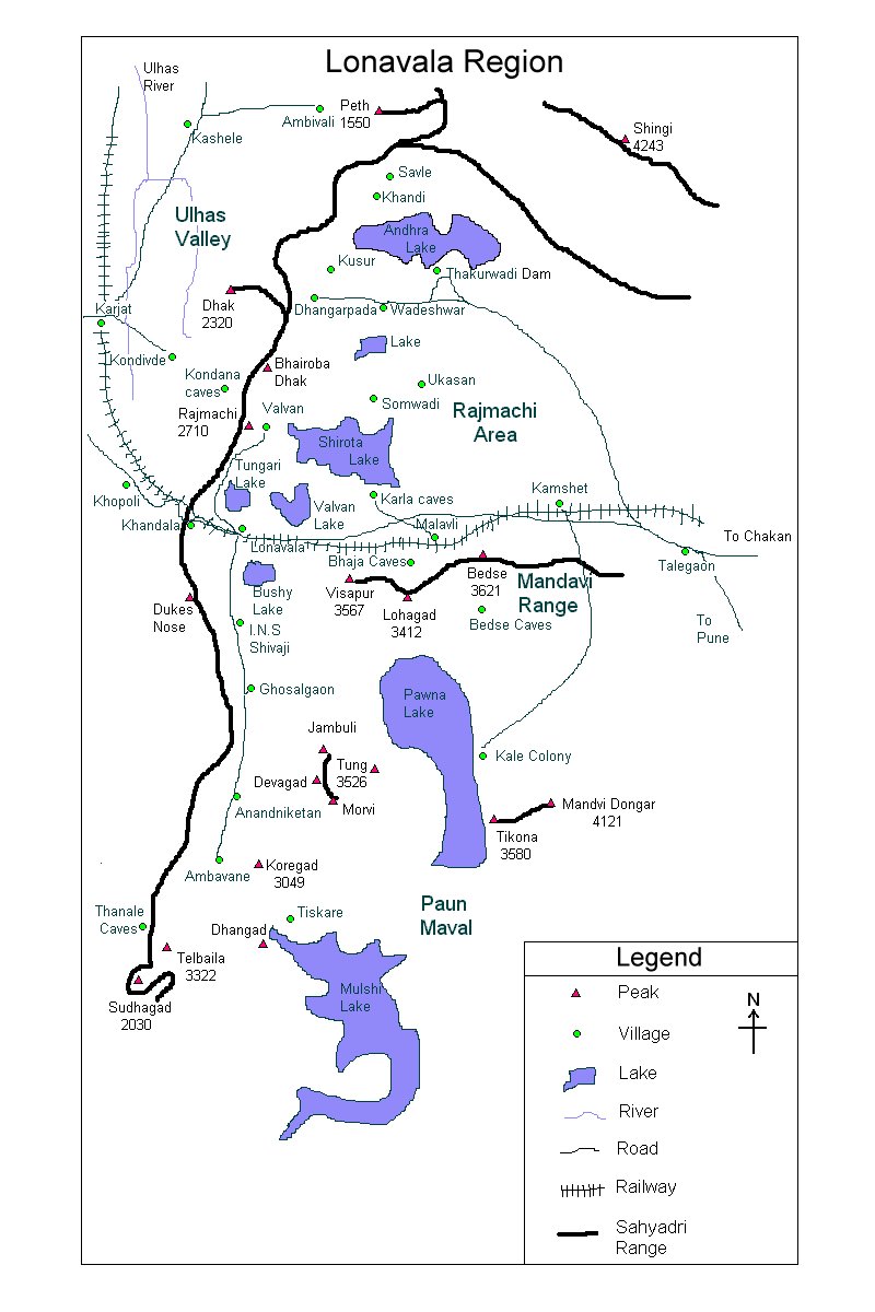
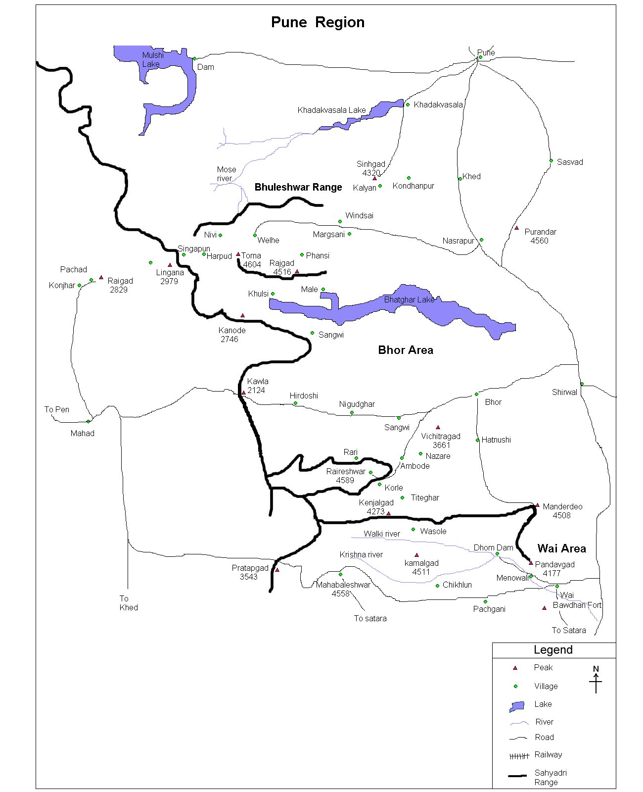
Go to Karjat by train or S.T. from
Karjat catch a bus for Khandas (1st bus at 10:00 am) Karjat Khandas distance is about 40
km. |
| Time to reach the top |
About 4 - 4 Ẅ hrs from Khandas |
| Water Availability |
Water is available in Bhimashankar
village |
| Best season to visit |
Except summer, any time |
| Sights to visit |
Nagphani, Shiv temple |
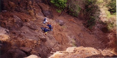
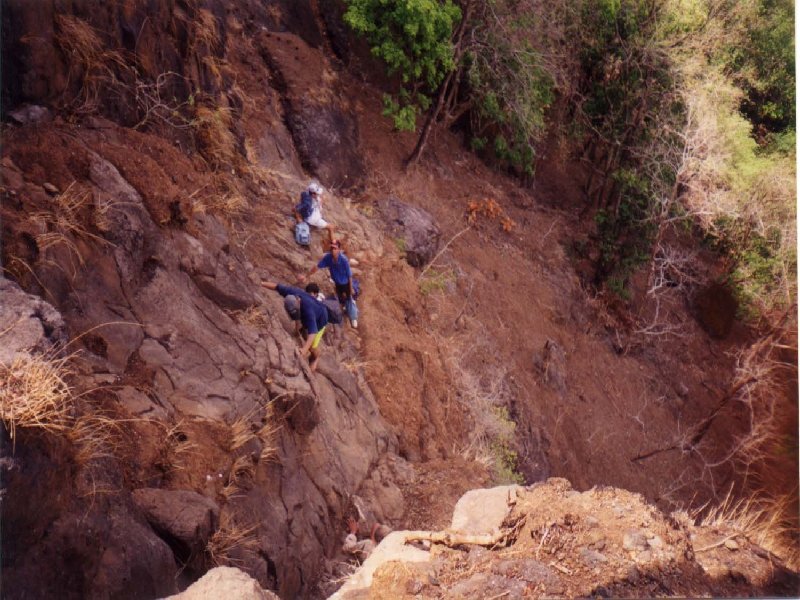
| Difficulty Rating |
A bit tough via shidi ghat, but
simple via Ganesh ghat
|
| Shelter |
Available in village Bhimashankar |
|
| Location |
 Bhimashankar is at a height of 3250 feet.
Karjat is the nearest station from which bus for Khandas can be caught (1st bus is at 10:00
a.m.). The 11/2 hour journey
(approximately 40 Km.) will take you to Khandas. The summit could be
embraced either by Ganesh Ghat or Shidi Ghat which
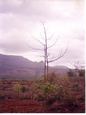
is a bit tough, but very much enjoyable. Going through to the dense forest will take you
to the top in around 4 hrs. Bhimashankar is at a height of 3250 feet.
Karjat is the nearest station from which bus for Khandas can be caught (1st bus is at 10:00
a.m.). The 11/2 hour journey
(approximately 40 Km.) will take you to Khandas. The summit could be
embraced either by Ganesh Ghat or Shidi Ghat which
is a bit tough, but very much enjoyable. Going through to the dense forest will take you
to the top in around 4 hrs. |
| |
| Sight Seeing |
 Bhimashankar as mentioned earlier is a famous pilgrimage spot, one
can visit Lord Shiva's temple at the top. Also don't forget to go to
Nagphani. Bhimashankar as mentioned earlier is a famous pilgrimage spot, one
can visit Lord Shiva's temple at the top. Also don't forget to go to
Nagphani. |
| |
| Note |
| All references regarding duration of trek and
transport are given with respect to Kalyan |
| Contact |
| cdeepan@gmail.com Deepan Ashok Choudhary |
| abhijit.avalaskar@gmail.com Abhijit Ulhas Avalaskar |
| Last updated on : 1st Dec 2005 |


 Bhimashankar as mentioned earlier is a famous pilgrimage spot, one
can visit Lord Shiva's temple at the top. Also don't forget to go to
Nagphani.
Bhimashankar as mentioned earlier is a famous pilgrimage spot, one
can visit Lord Shiva's temple at the top. Also don't forget to go to
Nagphani.