| Rohida
|
| At a Glance |
| Trek |
Rohida |
| Alias |
- |
| Type |
Hill Fort |
| District |
Pune |
| Height above mean sea
level |
~ 3650 ft ( ~1110 m) |
| Base
Village |
Bazarwadi |
| Minimum
Duration |
2 days |
| Region |
Bhor |
| Transport |
Kalyan to Pune (road/rail, ~ 150 km)- Bhor
(road, 50 km) - Bazarwadi (road - ~ 5 km) |
| Time to
reach the top |
About 1 1/2 - 2
hrs from Bazarwadi |
| Water
Availability |
Water cistern near first darwaja (gate) |
| Best
season to visit |
June to
February |
| Sights to
visit |
A bastion, mandir, Darwaja, water cisterns |
| Difficulty Rating |
Simple |
| Shelter |
- | |
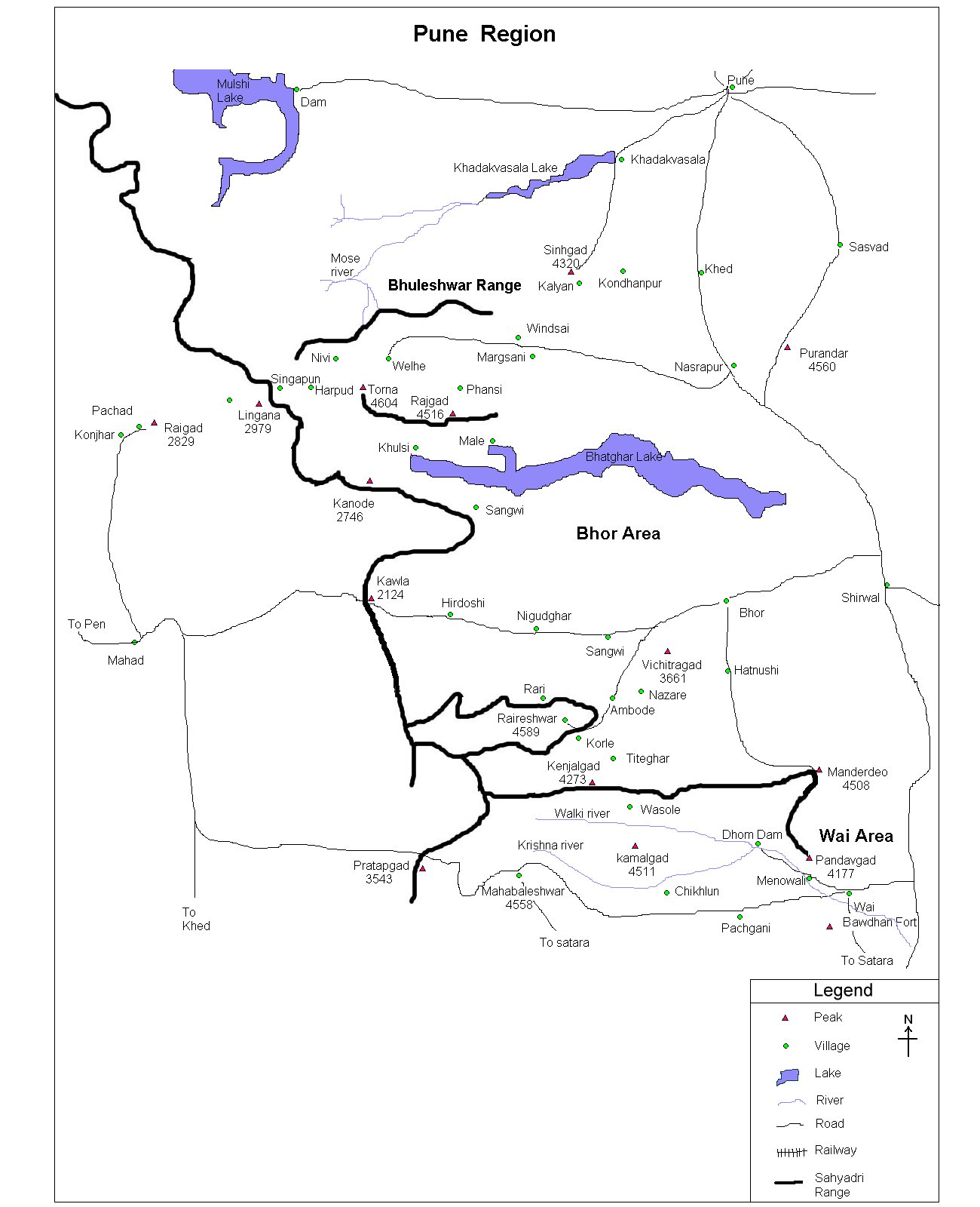
| Location |
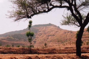
This fort is situated very close to Bhor - a historical sansthan. Reaching Pune, one can catch a ST going to
bhor and then to Bazarwadi, which is hardly 4-5 km from Bhor.
|
| |
| Precaution |
| No special precaution is needed. |
| |
| Sight Seeing |
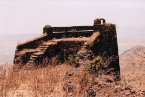
The top is quite barren and doesn't hold too many remnants.
However, ancient Rohideshwar mandir, different styled bastions (Korigad also has similar construction of bastion), water reservoirs (water not potable though) is worth
seeing. |
| |
| |
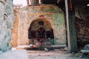
Rohideshwar mandir
|
| |
| Note |
| All references regarding duration
of trek and transport are given with respect to Kalyan, which is
about 50 km north-east of Mumbai. |
| Contact |
| cdeepan@gmail.com Deepan Ashok Choudhary |
| abhijit.avalaskar@gmail.com Abhijit Ulhas Avalaskar |
| Last updated on : 1st Dec 2005 |
