

| Home | Maps | Trekking Material | Forts |
| Maps |
| Karjat Region |
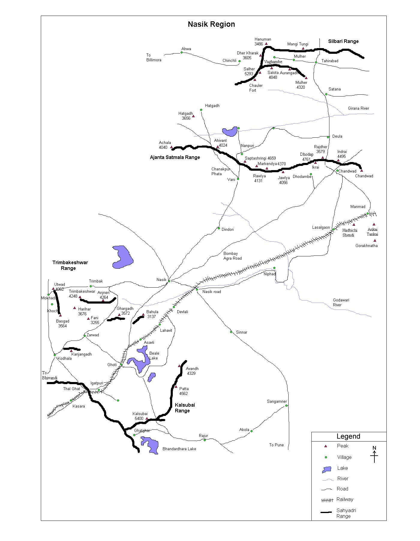
| Nasik Region |
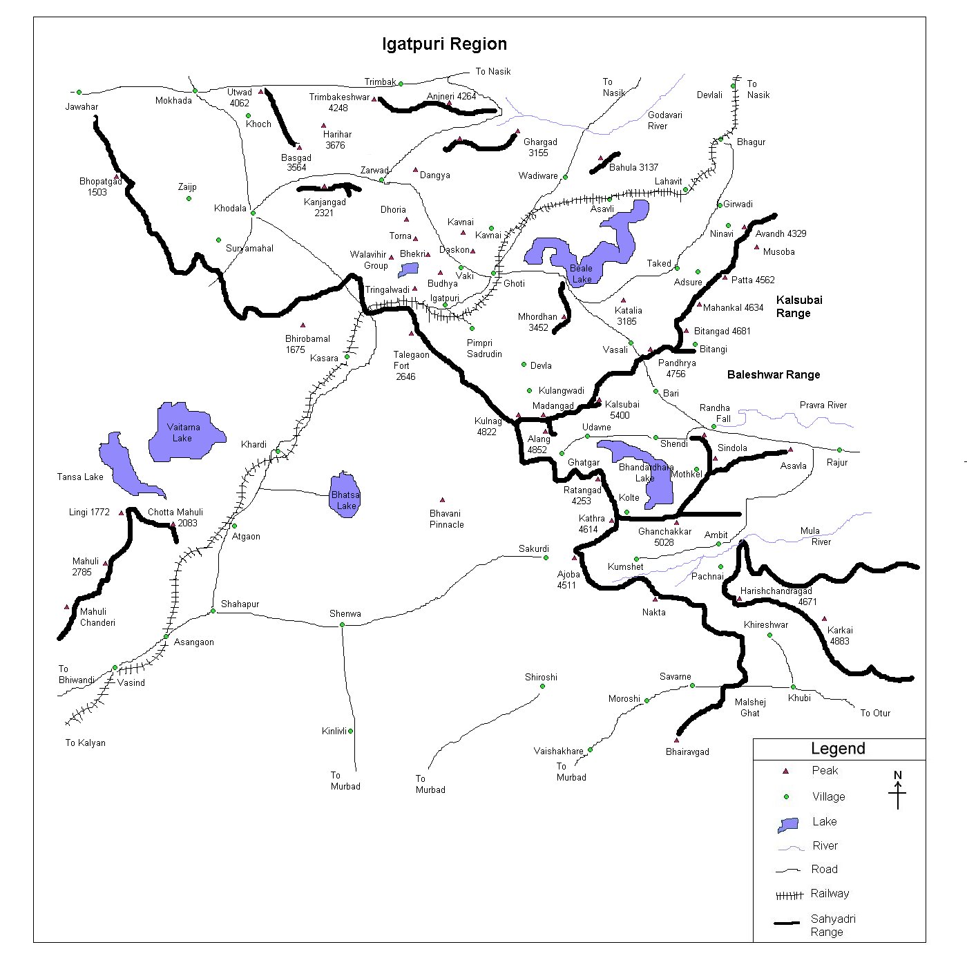
| Igatpuri Region |
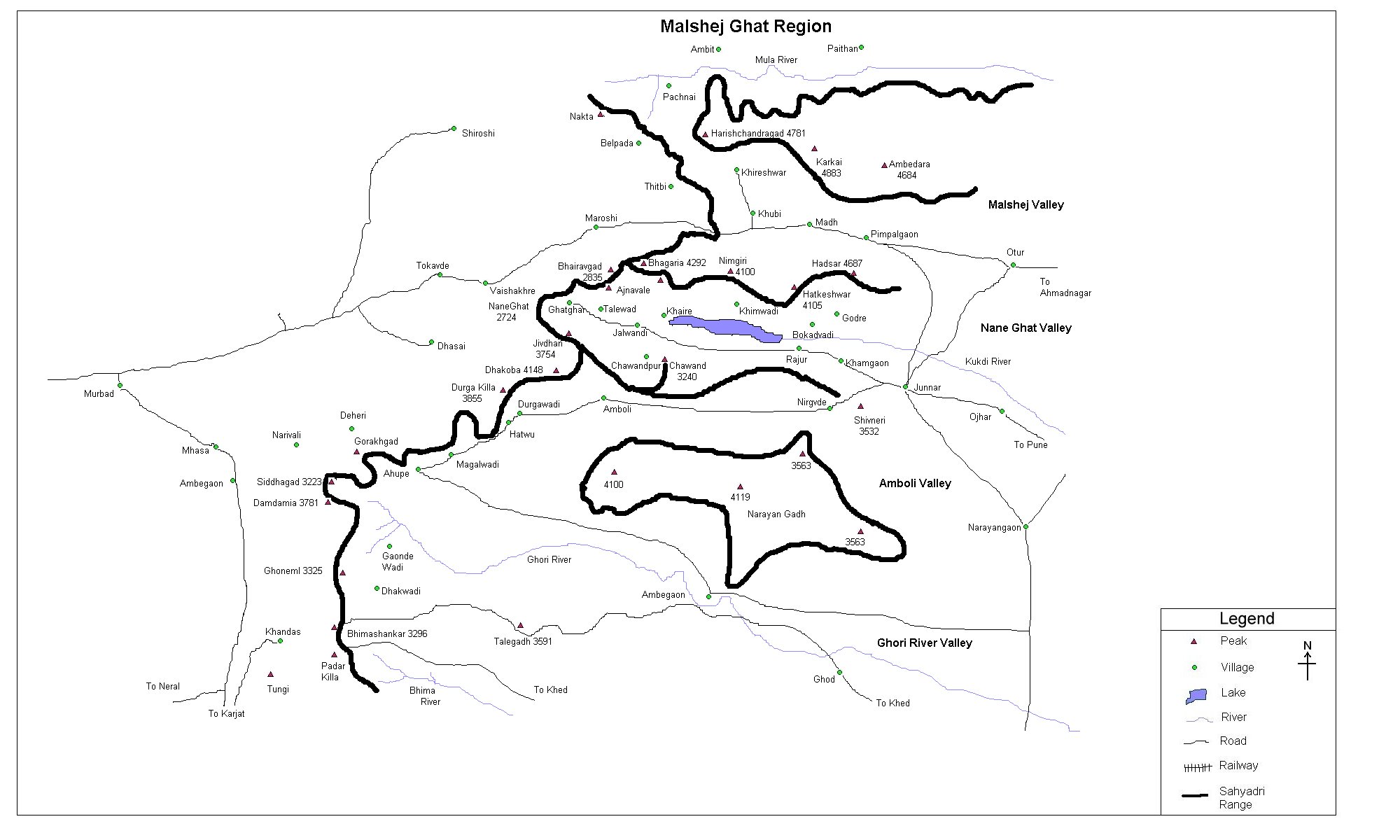
| Malshej Ghat Region |
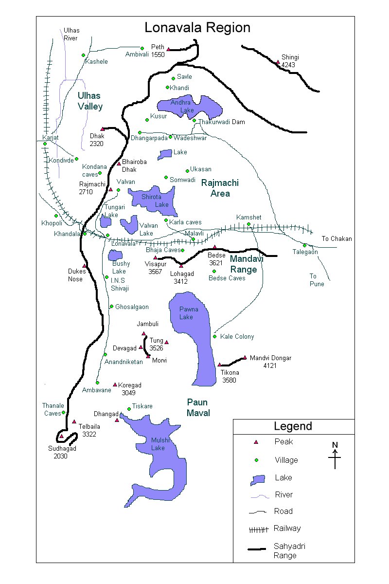
| Lonavala Region |
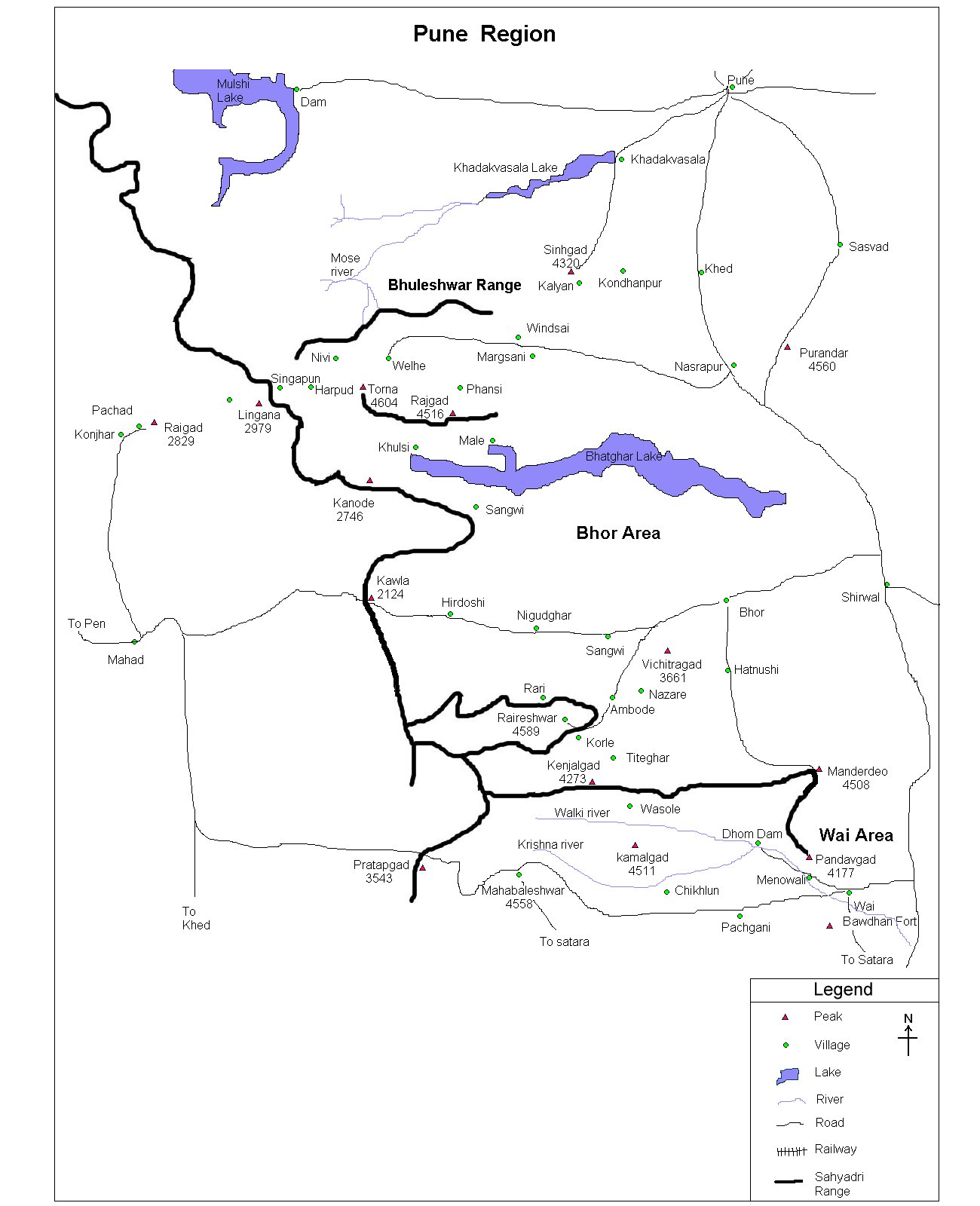
| Pune Region |
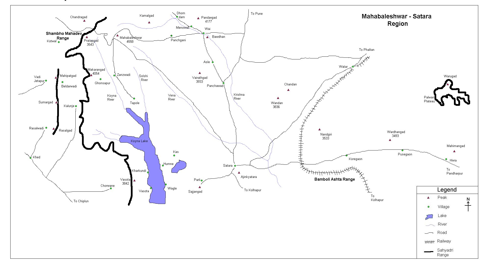
| Satara Region |
| Trekking |
| Material |
| Kulanggad | ||||||||||||||||||||||||||||||
| At a Glance | ||||||||||||||||||||||||||||||
|
||||||||||||||||||||||||||||||
| Location | ||||||||||||||||||||||||||||||
|
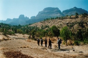
Igatpuri, being the main station after theThal ghat, can be approached either by rail or road. Catch the 1st bus (at about 8.30 am) for village Bhavli, and then walk for about 2 hours to the base village Kurung wadi. Take some rest and then get ready for a really wonderful 3 hours trek then on. |
||||||||||||||||||||||||||||||
| Precaution | ||||||||||||||||||||||||||||||
 Kurung wadi is the last place for getting
potable water till you reach the top, so get your bottles filled
with water in Kurung wadi itself. Take some rest, for here on you
will have to cover a fairly steep climb for about 3 hours at least!
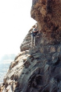
Just when your feet start talking, you get to see some
wonderfully carved steps in the rock....with a steep wall of rock on
one side and a deep valley on the other side! This patch has to
covered with enough care, for by this time you are very tired and
might just lose your concentration.....So be careful!
During the trek like this just remember one
thing......Nothing is dangerous if you take enough
care!. Kurung wadi is the last place for getting
potable water till you reach the top, so get your bottles filled
with water in Kurung wadi itself. Take some rest, for here on you
will have to cover a fairly steep climb for about 3 hours at least!
Just when your feet start talking, you get to see some
wonderfully carved steps in the rock....with a steep wall of rock on
one side and a deep valley on the other side! This patch has to
covered with enough care, for by this time you are very tired and
might just lose your concentration.....So be careful!
During the trek like this just remember one
thing......Nothing is dangerous if you take enough
care!. |
||||||||||||||||||||||||||||||
| Sight Seeing | ||||||||||||||||||||||||||||||
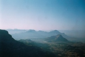
The panoramic view offered from the top of Kulang is one of the best in the Sahyadris. One can see the forts in the Kalsubai range, Baleshwar range and hills right upto Naneghat and Dhakoba |
||||||||||||||||||||||||||||||
| More photographs | ||||||||||||||||||||||||||||||
On a very clear day, with a blue firmament on the back ground and small huts in the foreground, makes this a picturesque scene For more photographs follow this link |
||||||||||||||||||||||||||||||
| Note | ||||||||||||||||||||||||||||||
| All references regarding duration of trek and transport are given with respect to Kalyan | ||||||||||||||||||||||||||||||
| Contact | ||||||||||||||||||||||||||||||
| cdeepan@gmail.com Deepan Ashok Choudhary | ||||||||||||||||||||||||||||||
| abhijit.avalaskar@gmail.com Abhijit Ulhas Avalaskar | ||||||||||||||||||||||||||||||
| Last updated on : 1st Dec 2005 |
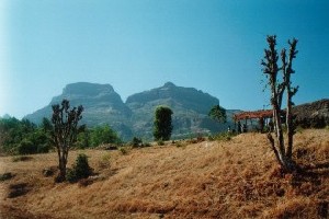
 Standing in the front yard of Igatpuri bus stand,
the attractive sierra - dominated by this very fort in the east - is a sight to enjoy! Offering the highest
climb from the base village in the entire Sahyadri ranges, this fort
offers one of the greatest panorama from its top.
Standing in the front yard of Igatpuri bus stand,
the attractive sierra - dominated by this very fort in the east - is a sight to enjoy! Offering the highest
climb from the base village in the entire Sahyadri ranges, this fort
offers one of the greatest panorama from its top.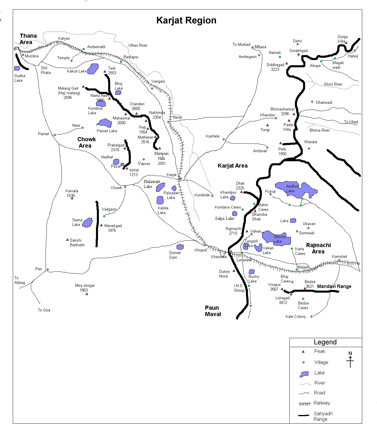